Bolivia delivers South America’s most surreal landscapes, where white salt crusts stretch beyond curved horizons and cable cars soar over canyon cities. Yet travelers often compromise trips through two critical errors: flying directly into high-altitude La Paz without acclimatizing, and underestimating Altiplano distances. Conquering Bolivia without debilitating altitude sickness or endless transit exhaustion requires structuring your itinerary from lower valleys upward.
By starting in colonial Sucre at 2,810 meters, your body adapts to thin mountain air before ascending to Potosí at 4,090 meters and embarking on a 4WD expedition across Salar de Uyuni. Finishing in La Paz at 3,640 meters ensures you explore the capital with full stamina, ready to ride the Mi Teleférico network.
Altitude Strategy & Route Architecture: Sucre, Potosí, Uyuni & La Paz
Acute Mountain Sickness (locally known as soroche) is an unavoidable physiological reality in western Bolivia. El Alto International Airport sits at 4,061 meters above sea level, an extreme elevation where air pressure drops to roughly sixty percent of sea-level density. Arriving visitors who immediately undertake strenuous sightseeing in La Paz or head directly onto the high Altiplano frequently suffer headaches, nausea, and sleeplessness. The smartest tactical itinerary reverses this trajectory by utilizing domestic air connections to begin in Bolivia’s constitutional capital, Sucre.
Three nights in Sucre allow red blood cells to adapt comfortably in a mild climate while exploring white courtyards. From Sucre, a three-hour drive ascends to Potosí (4,090m) for an overnight base. Heading westward brings you to Uyuni (3,656m) for a three-day 4WD expedition into Eduardo Avaroa Reserve reaching 4,850 meters, before a one-hour flight returns you to La Paz.
| Day | Base | Key Stops & Cultural Sightseeing | Transit Mode | Transit Time | Advance Bookings Required |
|---|---|---|---|---|---|
| Day 1 | Sucre | Arrive SRE via Santa Cruz/La Paz, Plaza 25 de Mayo, Casa de la Libertad | Airport taxi (25 min) | 25 minutes | Domestic flight to SRE |
| Day 2 | Sucre | Convento de San Felipe Neri rooftop, Cal Orck’o dinosaur footprints, artisan markets | Foot / local micro | None (walkable) | San Felipe Neri afternoon entry |
| Day 3 | Potosí | Scenic mountain highway drive, Casa Nacional de la Moneda, colonial mint vaults | Private car or bus | 3 hours | Casa de la Moneda guided tour |
| Day 4 | Salar de Uyuni | Transfer to Uyuni, train cemetery, Colchani salt processing, Incahuasi cactus island | Car + 4WD Land Cruiser | 3.5 hours | 3-Day Uyuni 4WD expedition slot |
| Day 5 | Altiplano Deserts | Ollagüe volcano viewpoint, high-altitude lagoons, Árbol de Piedra, Laguna Colorada | 4WD Land Cruiser | Full-day expedition | Eduardo Avaroa park cash entry |
| Day 6 | Uyuni / La Paz | Sol de Mañana geysers (4,850m), Polques hot springs, Laguna Verde, return flight to LPB | 4WD + domestic flight | 1-hour flight | BOA domestic flight to La Paz |
| Day 7 | La Paz | Mi Teleférico cable car circuit, Mercado de las Brujas, Calle Jaén colonial museums | Cable car network | 30 minutes | Mi Teleférico transit card |
| Day 8 | La Paz | Valle de la Luna clay formations, Sopocachi culinary dining, sunset over Illimani | Local taxi / cable car | 25 minutes | Evening dining reservation |
| Day 9 | La Paz | El Alto market panorama, Tiwanaku pre-Inca ruins excursion, departure transfer | Private transport / LPB | 45 minutes | International flight check-in |
This sequence turns altitude management into an asset rather than a liability. By pacing your ascent systematically, you avoid losing vacation days confined to hotel rooms hooked to supplemental oxygen tanks.
Sucre & Potosí: Colonial Splendor and Cerro Rico
Sucre is Bolivia’s most elegant colonial city. A UNESCO World Heritage site, municipal bylaws require its facades to be repainted in white lime wash annually. At Casa de la Libertad on Plaza 25 de Mayo, revolutionary leaders signed Bolivia’s 1825 declaration of independence.
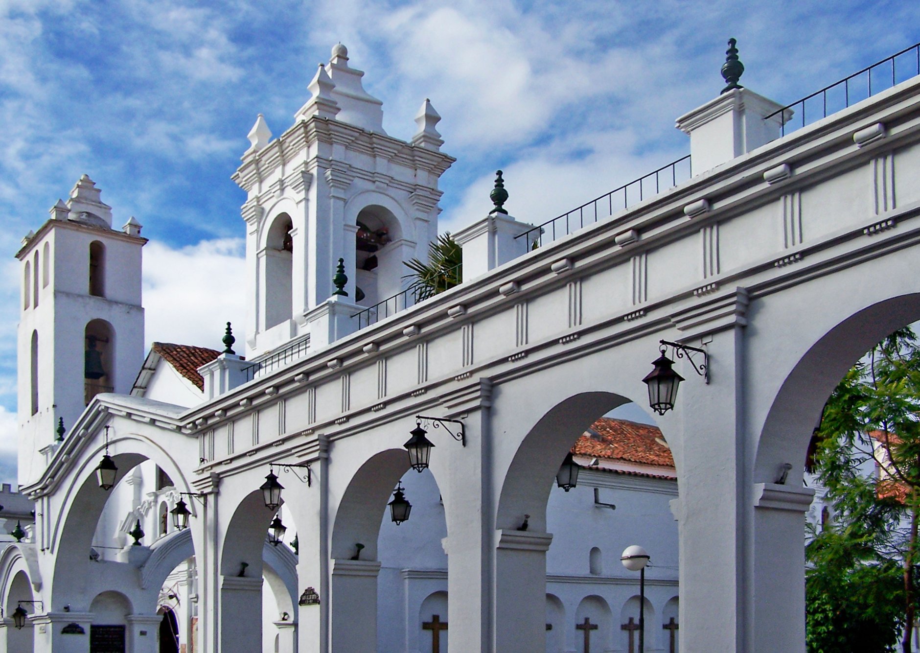
For sweeping views over the terracotta roof tiles, climb to the roof of the eighteenth-century Convento de San Felipe Neri. Wandering along the tiled parapets surrounded by white stone belfries offers an exceptional panorama across the valley. Just five kilometers outside the city center lies Cal Orck’o, an astonishing near-vertical limestone quarry wall bearing more than twelve thousand individual dinosaur footprints from sixty-eight million years ago, making it the world’s largest concentration of prehistoric tracks.
Ascending into high peaks leads to Potosí, founded in 1545 after vast silver deposits were discovered inside Cerro Rico. In the seventeenth century, Potosí grew larger than Paris or Madrid, bankrolling the Spanish Empire. That wealth remains visible inside Casa Nacional de la Moneda, a fortress-like colonial mint with cedar-beamed ceilings and mule-driven rolling mills.
While visits inside the active cooperative silver mines of Cerro Rico are offered by local agencies, travelers should approach them with caution. Conditions inside the tunnels are harsh, hot, and dusty, with narrow shafts and toxic mineral dust. Many visitors find that exploring Potosí’s colonial architecture, baroque churches, and the Mint Museum provides a profound understanding of the city’s complex legacy without entering hazardous subterranean passages.
The Salar de Uyuni: Salt Crusts and Island Oases
Leaving Potosí and descending toward the edge of the southwestern Altiplano leads to Uyuni, the staging post for the planet’s largest salt flat. Covering 10,582 square kilometers at an elevation of 3,656 meters, the Salar de Uyuni was formed when several prehistoric giant lakes evaporated over tens of thousands of years, leaving behind a thick crust of lithium-rich brine and solid salt stretching flat to the horizon.
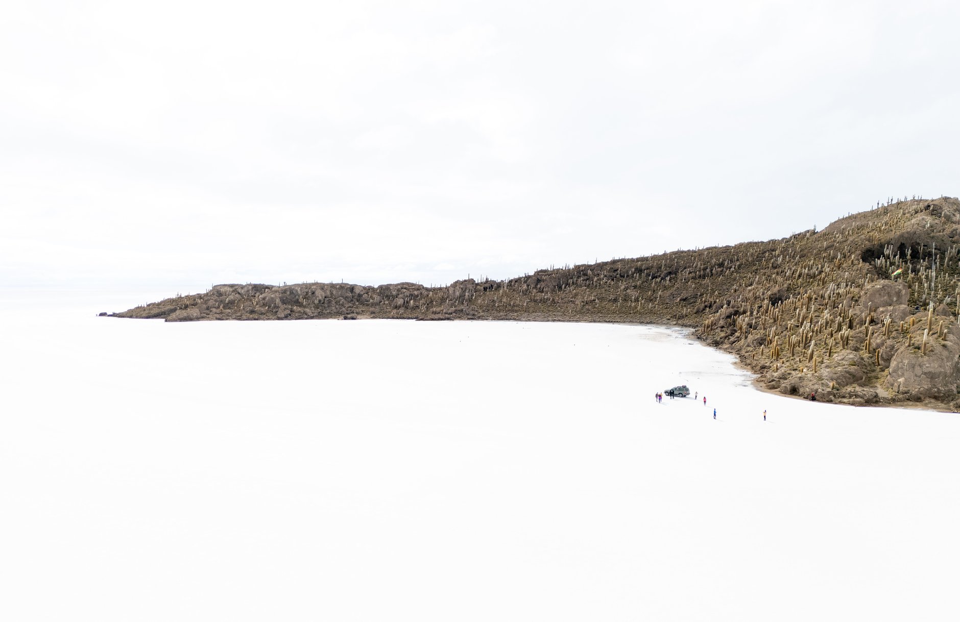
From May through November, dry salt forms geometric hexagonal crusts stretching to the horizon, where absent reference points eliminate depth perception. In the rainy season from January to March, thin water transforms the flat into the world’s largest mirror, flawlessly reflecting clouds and stars.
Rising like a petrified fortress from the sea of salt is Isla Incahuasi, the rocky summit of an ancient submerged volcano. Covered in fossilized coral structures and thousands of giant columnar Trichocereus pasacana cacti—some measuring up to twelve meters in height and growing at a rate of just one centimeter per year—the island provides a surreal botanical refuge. Hiking the stone pathway to the summit yields an unforgettable 360-degree panorama of blinding white crust meeting cobalt sky.
The Eduardo Avaroa Reserve: High-Altitude Wonder
While many tourists do a rushed single-day trip onto the salt flat, the true majesty of southwestern Bolivia unfolds on a three-day four-wheel-drive circuit into the Eduardo Avaroa Andean Fauna National Reserve. Here, volcanic geothermal activity combines with mineral-saturated lakes to create landscapes that look like paintings from another planet.
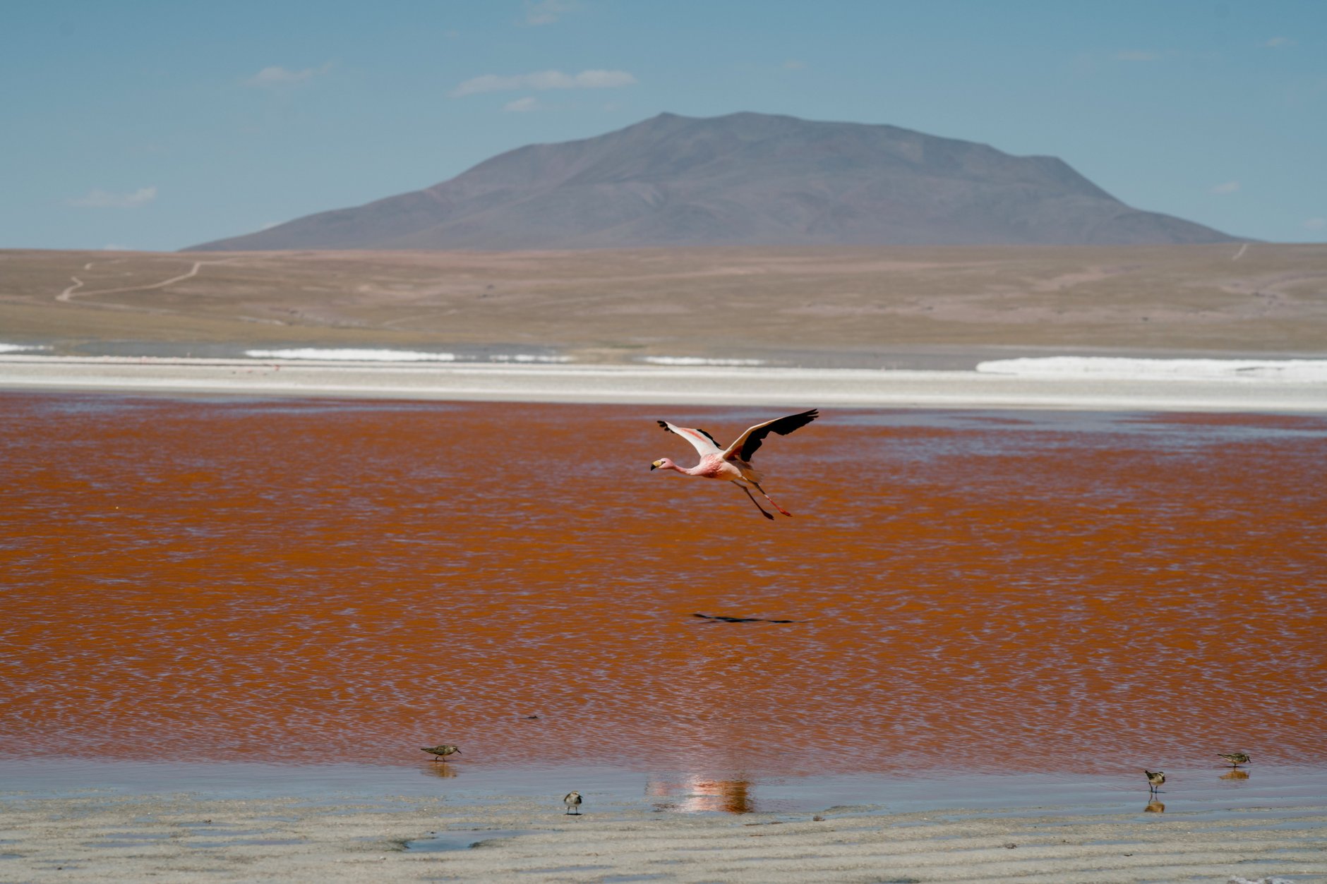
The reserve’s centerpiece is Laguna Colorada at 4,278 meters, where red sediment and pigmented algae tint the water crimson. White borax islands dot the lake, where thousands of rare James’s, Andean, and Chilean flamingos feed despite freezing winds.
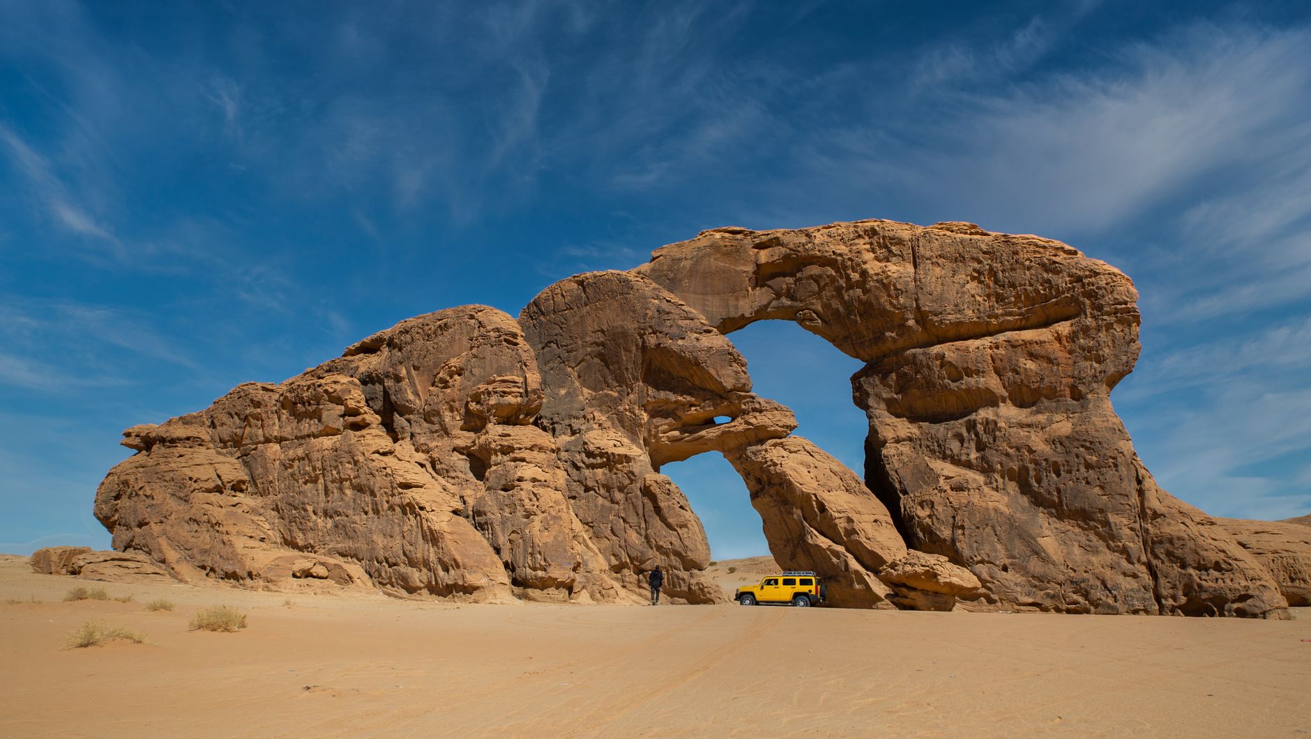
Continuing across the windswept Siloli Desert reveals the iconic Árbol de Piedra (Stone Tree), an isolated volcanic rock carved into a delicate tree shape by centuries of abrasive sandstorms. Further south, the trail climbs to Sol de Mañana at 4,850 meters, an intense geothermal field where boiling mud pots hiss, sulphur vents hiss into the frigid dawn air, and steam columns rise dozens of meters high. The circuit culminates at Laguna Verde, a luminous turquoise lake sitting at the foot of the symmetrical Licancabur volcano on the Chilean border.
La Paz: Urban Canyons and Aerial Transit
La Paz defies conventional geography, filling a volcanic canyon bowl gouged from the Altiplano. The city cascades from El Alto at 4,061 meters down to Zona Sur at 3,200 meters, creating a vertical drop of nearly a thousand meters within urban limits.
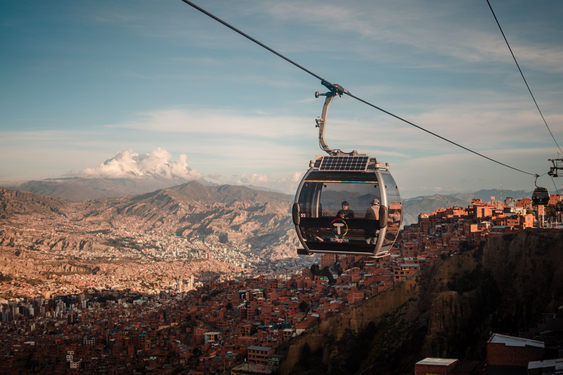
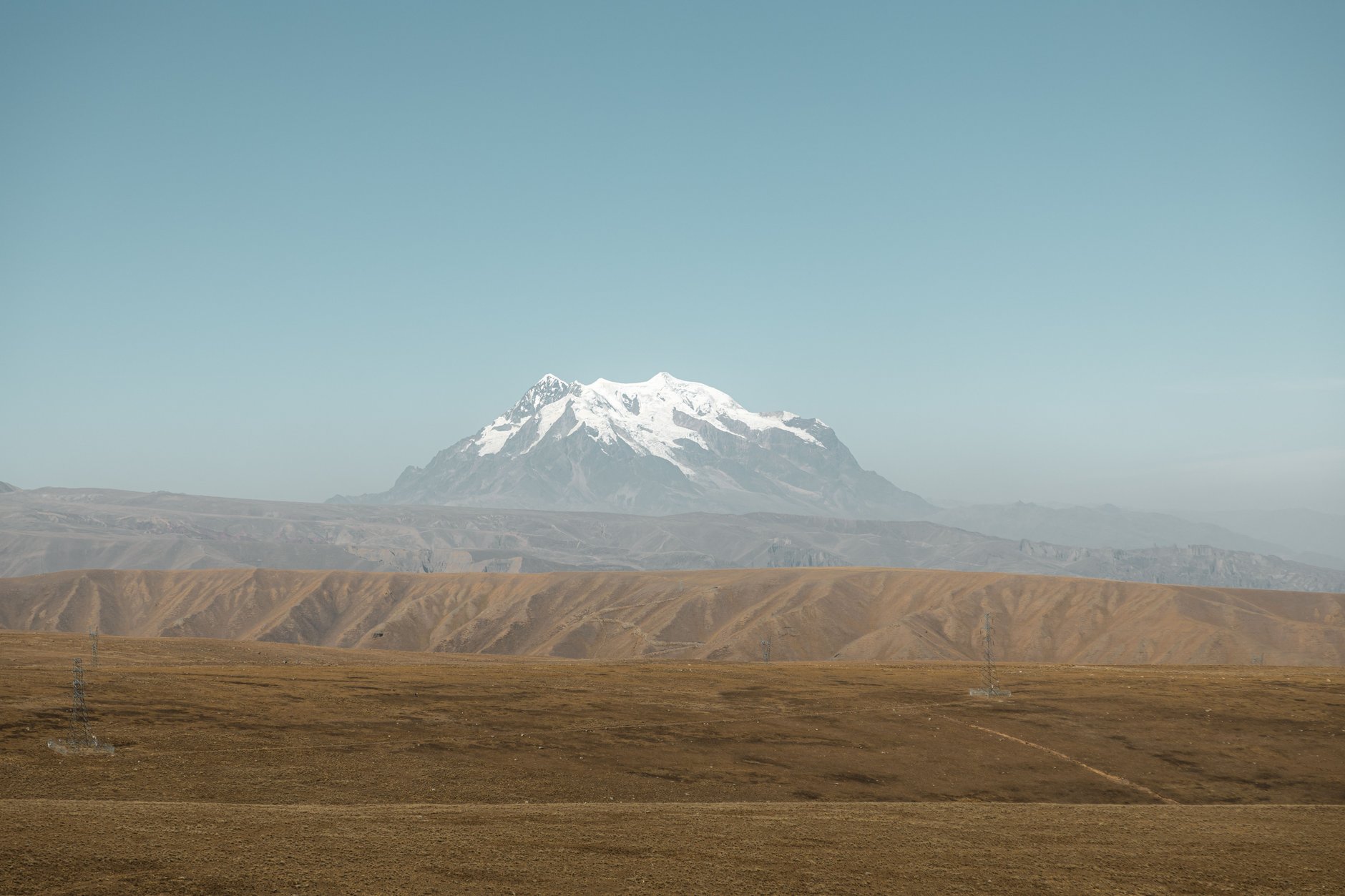
The best way to navigate La Paz is from above. In 2014, the city inaugurated Mi Teleférico, the world’s highest and most extensive urban cable car network. Ten color-coded lines connect the canyon rim to the valley floor, quietly gliding over red brick neighborhoods, bustling market streets, and steep ravines while framing snow-capped Mount Illimani (6,438 meters). A transit ride that once took two hours in stalled traffic now takes just seventeen minutes of smooth aerial flight, offering passengers spectacular bird’s-eye views for an affordable single fare of 3 BOB (approx. 0.45 USD).
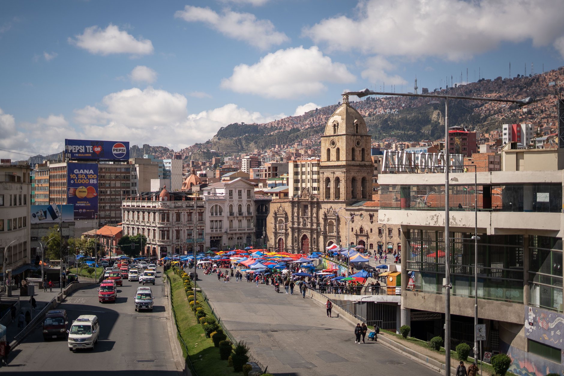
At ground level, downtown La Paz centers around Plaza Murillo and the historic Church of San Francisco. Behind the church along Calle Linares and Calle Sagárnaga lies the Mercado de las Brujas (Witches’ Market). Here, traditional Aymara herbalists and healers (yatiris) sell medicinal herbs, colorful amulets, and dried llama fetuses used as ritual offerings buried beneath the foundations of new homes to seek the blessings and protection of Pachamama (Mother Earth).
To witness the power of erosion in the southern valleys, travel ten kilometers down-canyon to Valle de la Luna (Moon Valley). Over millennia, heavy rains and mountain winds have sculpted clay and sandstone mountainsides into a maze of pale pinnacles, ridges, and spires that resemble an alien badlands landscape.
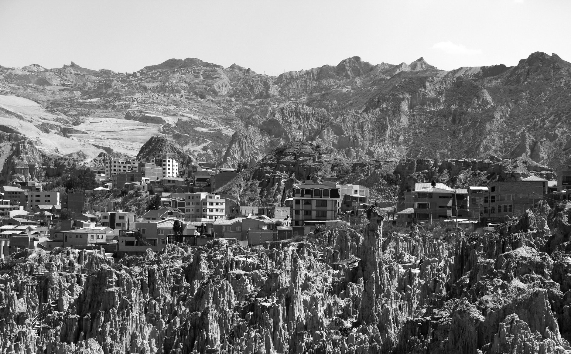
Well-maintained walking paths wind through the delicate formations, where desert cacti cling to steep ridges and mineral veins tint the clay towers in shades of violet, beige, and terracotta.
Culinary Culture & High-Altitude Gastronomy
Bolivian food is hearty, comforting, and deeply attuned to the caloric demands of highland living. Mornings across the country revolve around the ritual of the salteña, Bolivia’s beloved baked empanada. Distinct from flatter pastries found in Argentina or Chile, a salteña features a thick, slightly sweet golden dough crimped with an elegant braided ridge along the top.
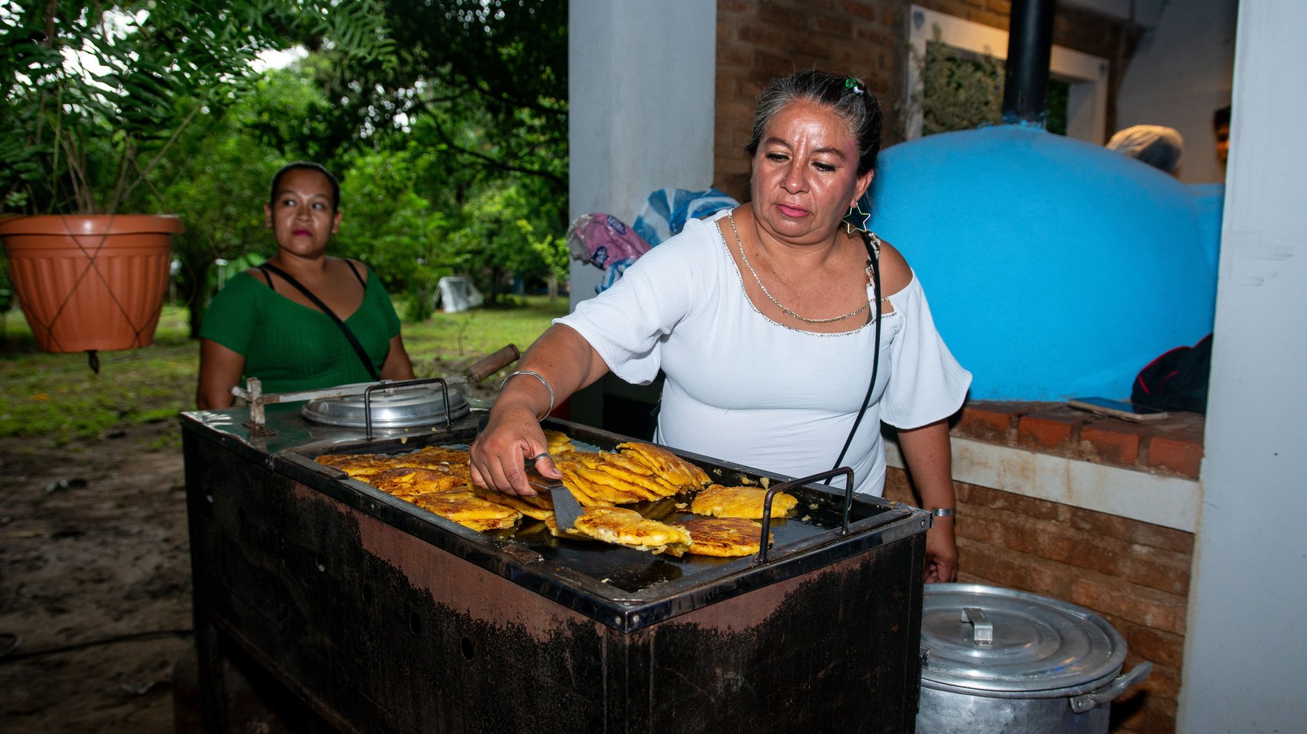
Inside, the filling is a rich, piping-hot gelatinous stew of beef or chicken, potatoes, peas, cumin, and spicy yellow ají pepper, often accented with hard-boiled eggs and purple olives. Eating a salteña without spilling the savory broth down your wrists requires technique: hold it upright, bite off the top corner, and sip the steaming soup before eating the savory filling.
Other traditional specialties include sopa de maní, a comforting soup made from ground raw peanuts, beef broth, beef ribs, peas, and crisp fried shoestring potatoes that warms travelers arriving from cold mountain drives. In Cochabamba and La Paz, order Pique Macho, a massive platter of stir-fried beef strips, sausages, french fries, onions, and spicy locoto peppers. To stay hydrated and soothe altitude discomfort, drink hot mate de coca (coca leaf tea) or mate de muña (Andean mint tea), staples served in every cafe and hotel lobby across the Altiplano.
Practical Transport Logistics: Buses, Flights & 4WD
Overcoming Bolivia’s immense mountain geography requires strategic transit choices. Between distant primary hubs like La Paz, Sucre, and Uyuni, domestic flights operated by Boliviana de Aviación (BOA) save immense travel time. A flight between La Paz and Uyuni takes just forty-five minutes, sparing travelers an exhausting ten-hour overland bus journey across bumpy terrain.
For mid-distance intercity legs, such as Sucre to Potosí, private taxis or public minibuses (colectivos) depart frequently from regional terminals and cover the paved highway in roughly three hours. If booking long-distance night buses (such as between Potosí and Uyuni or Uyuni and La Paz), always choose bus-cama (full sleeper) class from established operators like Todo Turismo or Trans Omar, which offer reclining seats, onboard heating, and luggage baggage receipts.
When booking a three-day Salar de Uyuni expedition, vet your agency thoroughly. Low-cost operators frequently cut safety corners by skipping vehicle maintenance, overloading roof racks, or lacking satellite communications and oxygen tanks. Select reputable operators with modern Toyota Land Cruisers, certified professional driver-guides, and confirmed bookings at heated eco-lodges or salt hotels rather than primitive communal dormitories.
Travel Safety & Common Scams to Avoid
Bolivia is generally safe for travelers who exercise basic common sense, but opportunistic crime, transit theft, and organized impersonation scams exist in major cities and tourist corridors. Being vigilant will ensure your trip proceeds smoothly.
- Bogus Tourist Police & Drug Inspections: In downtown La Paz or near transit terminals, plainclothes individuals approach travelers flashing fake police badges, claiming to investigate “counterfeit currency” or “tourist narcotics.” An accomplice disguised as a tourist pretends to comply. The impostors insist you hand over your passport and wallet or get into an unmarked taxi. Legitimate Bolivian police never inspect documents in plainclothes or demand money on the street; refuse and walk into a hotel or bank.
- Unlicensed Uyuni 4WD Budget Operators: Rogue agencies in Uyuni town aggressively solicit travelers with heavily discounted tours, only to use poorly maintained vehicles lacking working seatbelts, spare tires, or emergency satellite radios. In extreme cases, drivers consume alcohol on remote desert routes. Book only through licensed, highly reviewed operators and inspect the vehicle before departing.
- Luggage Slicing on Long-Distance Night Buses: On overnight buses between La Paz, Sucre, and Uyuni, thieves board at intermediate stops and slice open backpacks stored in overhead luggage racks or under seats while passengers sleep. Keep all electronics, passports, and cash in a small daypack strapped to your chest, and never leave valuables in the cargo hold.
- Counterfeit Boliviano Banknotes: Deceptive change handed back in street markets, bars, or informal taxis occasionally includes counterfeit hundred- and two-hundred-boliviano bills. Authentic currency features raised tactile printing, clear watermarks, and color-shifting ink on security threads. Check large bills carefully and carry smaller denominations (ten-, twenty-, and fifty-boliviano notes) for everyday purchases.
- El Alto Airport Unmetered Taxi Fares: Informal cab drivers outside the arrival terminal at El Alto charge unsuspecting foreigners a high cash fare for rides down into central La Paz, which should cost far less. Book through the official airport taxi kiosk inside the terminal or ride the direct Airport Express bus to the Mi Teleférico station.
- Spilled Mustard / Droppings Distraction Scam: Near the San Francisco church or along pedestrian shopping avenues in La Paz, an accomplice discreetly squirts mustard, chocolate, or white liquid onto your jacket. Another “concerned” local immediately steps forward with tissues to help clean you off, while picking your pockets or running off with your daypack. Firmly wave them away and step inside a shop to clean yourself.
Remaining alert in crowded markets, refusing unsolicited assistance from strangers on the street, and locking daypacks in transit will keep your Bolivian journey safe and memorable.
Mobile Connectivity & eSIM Intelligence for Bolivia
High-altitude expeditions across the Bolivian Altiplano demand dependable mobile communication. Whether coordinating four-wheel-drive pickup locations, tracking offline GPS routes through unmarked desert passes, or monitoring weather changes in the Eduardo Avaroa Reserve, having reliable cellular data provides an invaluable safety lifeline.
Purchasing a physical prepaid SIM card upon arrival in Bolivia can be exceptionally frustrating. Telecommunications regulations require in-person passport registration, biometric fingerprinting, and physical document verification at official carrier branches (such as Entel or Tigo). Kiosks at El Alto Airport rarely have staff authorized to register foreign passports, requiring travelers to spend half a day navigating Spanish bureaucracy in downtown telecom offices.
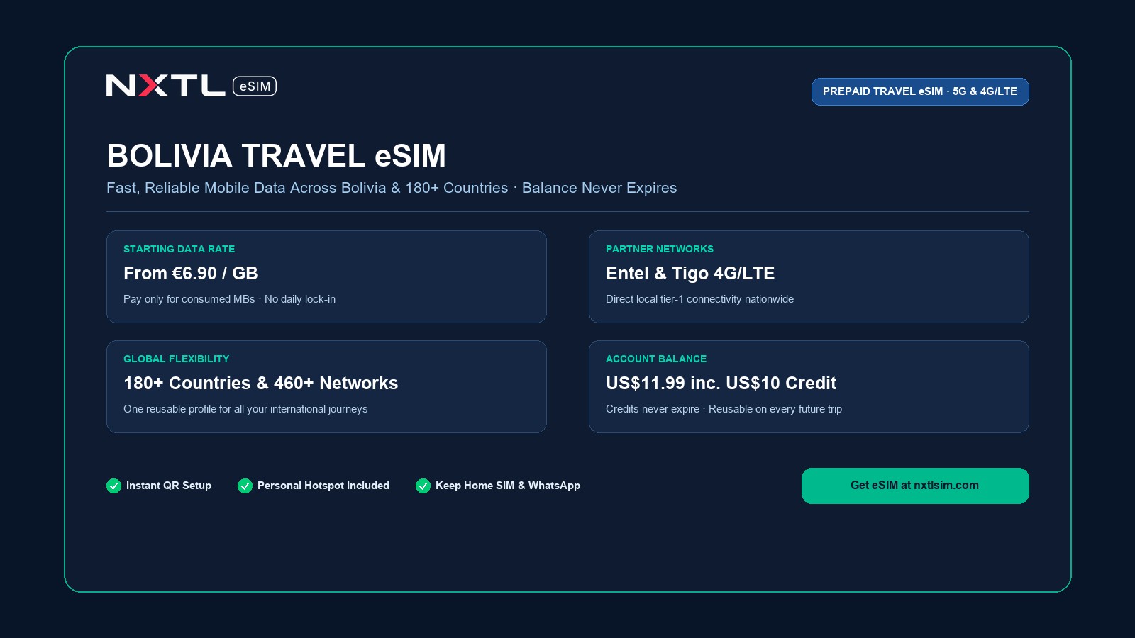
A digital global eSIM offers a vastly superior solution. With NXTL, you connect directly to top Bolivian cellular networks the moment your flight touches down at El Alto or Santa Cruz, without physical paperwork, store queues, or swapping plastic cards. NXTL operates on a transparent pay-as-you-go balance model, delivering high-speed cellular data in Bolivia starting at EUR 6.90 per gigabyte.
In Bolivia, this pricing reflects the reality of maintaining high-altitude satellite backhauls and remote cellular towers across vast, uninhabited Andean plateaus. Rather than being a commodity, NXTL serves as an indispensable expedition asset, charging only for the exact megabytes you consume. With real-time billing, you avoid paying for expensive 10-gigabyte bundles that expire unused while you are hiking through off-grid canyons.
Crucially, NXTL connects you via multi-carrier failover across Bolivia’s leading nationwide network operators: Entel Bolivia and Tigo. Entel maintains the most extensive rural cellular network across the Altiplano and Andean highways, while Tigo offers robust high-speed 4G/LTE in urban centers like La Paz, Sucre, and Cochabamba. Full personal hotspot and tethering functionality is enabled, allowing you to share connectivity with navigation tablets and companion devices.
Getting started is simple. For $11.99, you receive your universal eSIM profile with $10 in preloaded account balance. Because your balance never expires and covers 180+ countries and 460+ carrier networks worldwide, any remaining balance remains intact for your subsequent South American or global travels.