Bhutan presents one of the most deliberate travel models on earth. Known historically as Druk Yul, or the “Land of the Thunder Dragon,” this Eastern Himalayan kingdom avoided foreign colonization and mass tourism by enforcing a national policy of “High Value, Low Volume” tourism. Entering Bhutan requires intentional logistical planning: visitors must navigate the Sustainable Development Fee (currently 100 US dollars per person per night for international travelers following recent policy revisions), obtain an approved government tourist visa, and travel accompanied by a licensed Bhutanese guide and registered driver for all journeys outside urban municipal centers.
A classic seven- to eight-day Western Bhutan circuit provides the most rewarding introduction to the kingdom’s architecture, Buddhist traditions, and alpine geography. Connecting the flight gateway of Paro with the administrative capital of Thimphu, the subtropical valley of Punakha, the high glacial sanctuary of Phobjikha, and the culminating clifftop ascent to Paro Taktsang (Tiger’s Nest), this route requires careful acclimatization and pacing. Because the kingdom’s lateral mountain roads wind through high-altitude passes exceeding 3,100 meters, average driving speeds rarely surpass 35 kilometers per hour. Treating transfers as slow scenic journeys rather than quick highway connections is essential to enjoying the country.
Entering the Kingdom: Flights, Visas, and the Sustainable Development Fee
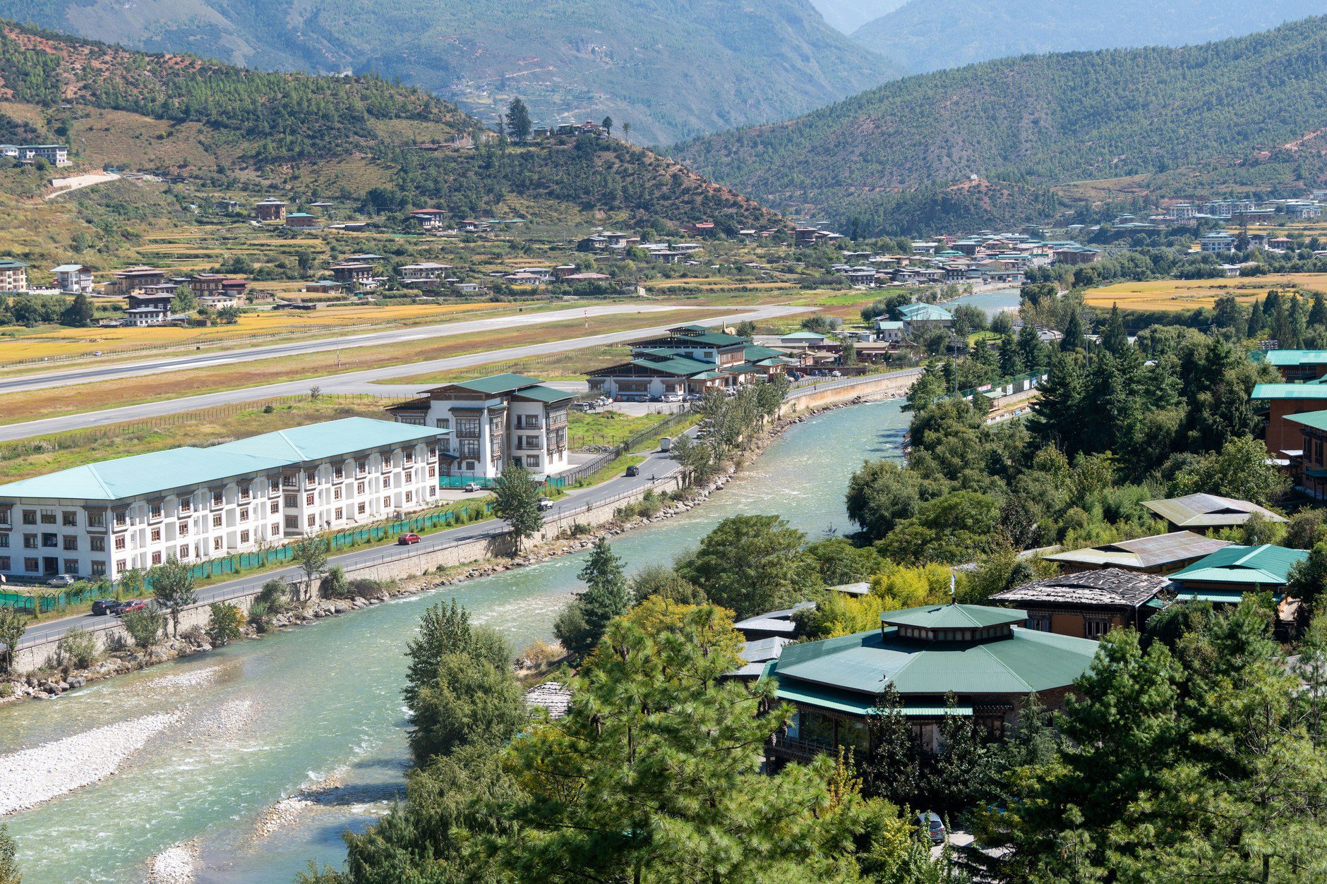
All international air travel into Bhutan funnels through Paro International Airport (PBH), located in a deep river valley at an elevation of 2,235 meters (7,332 feet). Surrounded by 5,500-meter Himalayan peaks, Paro is one of the world’s most demanding visual-approach runways. Commercial flights are operated exclusively by Drukair and Bhutan Airlines under visual flight rules (VFR), meaning morning arrivals are far less vulnerable to weather diversions than late-afternoon flights.
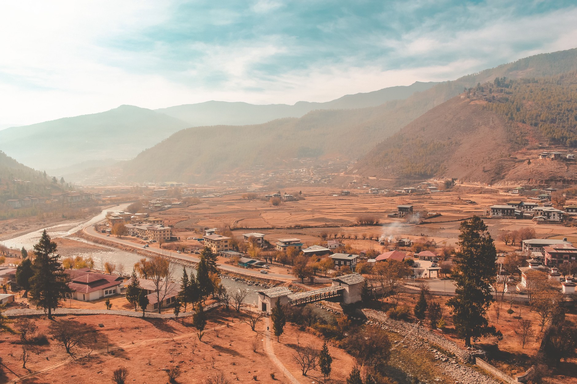
Travelers generally transit through Bangkok, Delhi, Kolkata, Kathmandu, or Singapore before boarding flights into Paro. During the clear weather windows of autumn (October through November) and spring (March through May), flights book out months in advance. Securing window seats on the left side of the aircraft when flying into Paro—or on the right side when departing—provides views across the central Himalayan chain, including Mount Everest, Kanchenjunga, and Bhutan’s unclimbed highest summit, Gangkhar Puensum.
The financial foundation of travel here is the Sustainable Development Fee (SDF), a statutory levy funding healthcare, education, and conservation across the kingdom. The international SDF stands at 100 US dollars per adult per night (50 percent discount for children aged 6 to 12), scheduled through September 2027. This fee is paid during online visa processing (40 US dollars fee) and does not cover lodging, meals, transport, or guide services, which are arranged separately with a licensed guide or operator.
Thimphu: The Himalayan Capital Without Traffic Lights
From Paro Airport, an hour’s drive along the paved expressway leads east to Thimphu, the kingdom’s political and commercial capital. Situated in a linear valley at an elevation of 2,330 meters along the banks of the Wang Chhu river, Thimphu remains the only national capital in the world operating without automated traffic lights. When municipal authorities installed an electric traffic signal in the city center years ago, public opposition prompted its swift removal; today, white-gloved traffic police officers direct vehicles with stylized, balletic hand gestures from an ornate roadside pavilion.
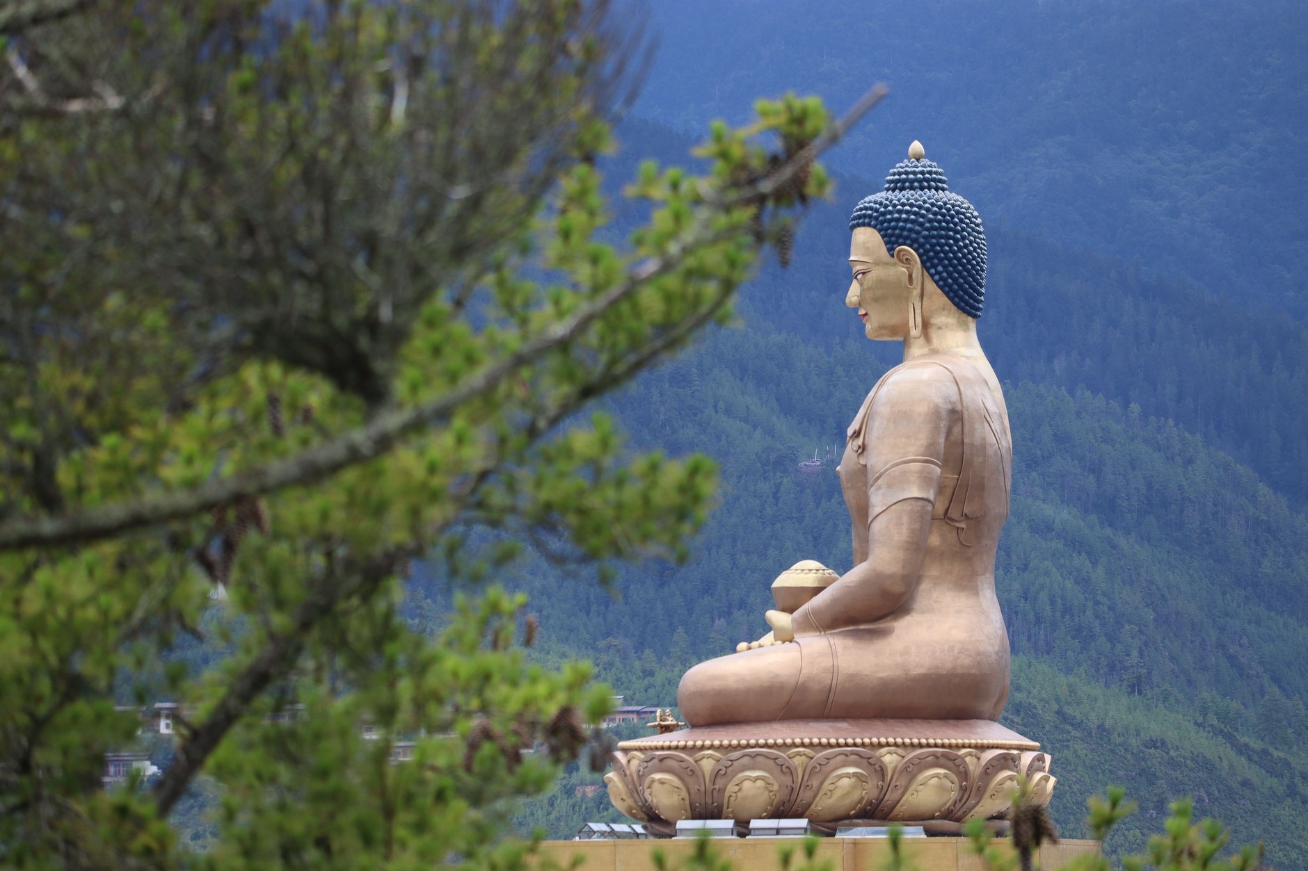
Thimphu balances traditional Himalayan identity with contemporary civic life. High above the valley perches Buddha Dordenma (Kuenselphodrang), a 54-meter bronze statue housing 125,000 smaller bronze Buddha figurines within its chest. The vantage point overlooks the urban basin, highlighting municipal codes mandating all buildings incorporate traditional timber cornices, floral motifs, and arched window frames.
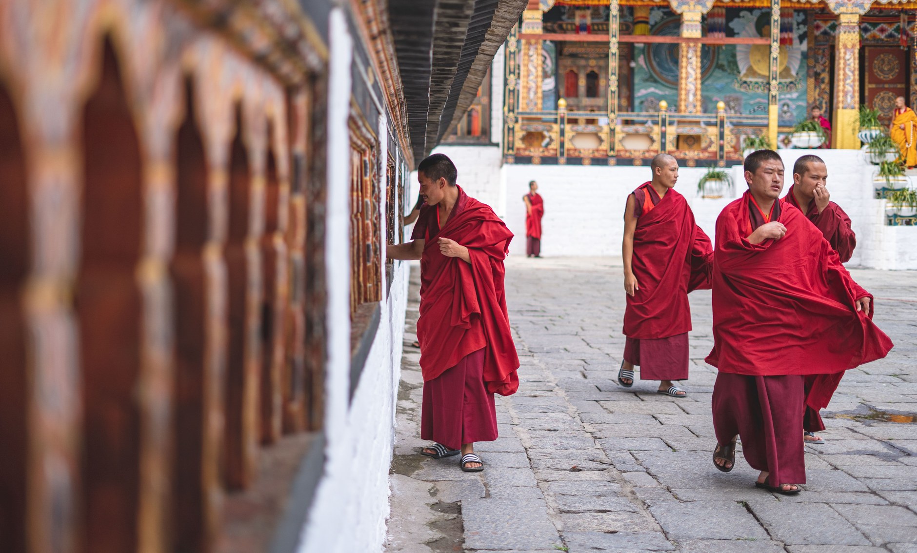
In the valley stands Tashichho Dzong, a fortress-monastery built without nails or blueprints. Housing the throne room of the King and the central monastic body, it opens to visitors in late afternoon after government ministries close. Watching crimson-robed monks assemble for evening chants reveals the seventeenth-century dual system of secular and spiritual governance.
At the National Institute for Zorig Chusum, apprentices master Bhutan’s thirteen traditional crafts, including thangka painting, woodcarving, bronze casting, and embroidery. Nearby, the Centenary Farmers Market draws rural growers selling dried yak cheese (chhurpi), green chilies, wild ferns, and mountain honey.
Dochula Pass and the Descent to Subtropical Punakha
Leaving Thimphu requires climbing eastward into the clouds toward Dochula Pass, which summits at an elevation of 3,100 meters (10,170 feet). The pass is crowned by the 108 Druk Wangyal Chortens—memorial stupas built under the patronage of the Queen Mother to honor Bhutanese soldiers who defended national sovereignty in 2003.
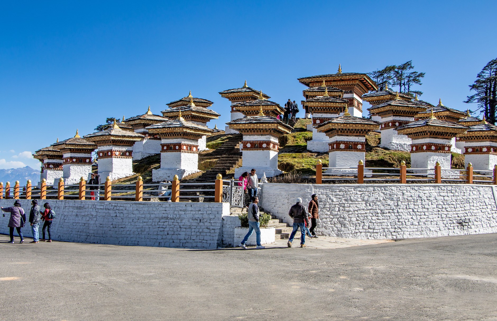
On clear mornings, Dochula Pass unveils an uninterrupted vista of the Eastern Himalayas, including snow-capped Masang Kang and Table Mountain. Thousands of colorful prayer flags (lung ta) strung between pines carry printed mantras across mountain ridges. In dense mist, the 108 stupas emerge quietly, creating an austere atmosphere.
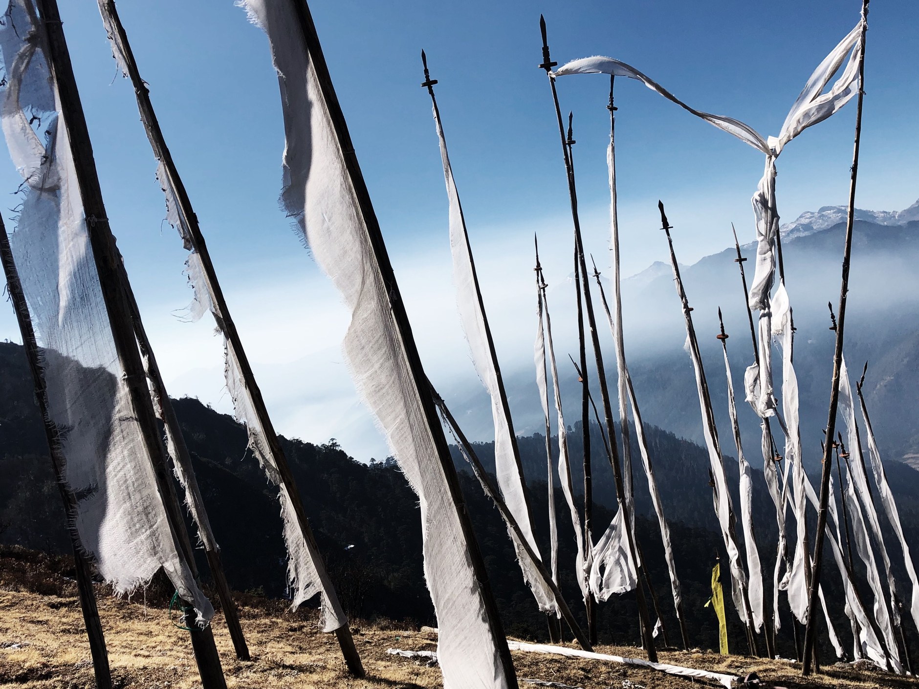
Beyond Dochula Pass, the highway plunges through dense rhododendron groves, magnolia forests, and bamboo thickets, descending over 1,900 vertical meters into the Punakha Valley. Because Punakha lies at an altitude of just 1,200 meters (3,937 feet), its climate is distinctly warm and subtropical. Banana trees, orange orchards, and terraced rice paddies replace the alpine pines of Thimphu, making the valley the historic winter residence of the Je Khenpo (Chief Abbot) and the central monastic body.
Punakha Dzong: The Palace of Great Happiness
Constructed in 1637 by Zhabdrung Ngawang Namgyal, the unifier of Bhutan, Punakha Dzong (formally Pungtang Dechen Photrang Dzong, or “The Palace of Great Happiness”) stands as the crown jewel of Bhutanese fortress architecture. Situated strategically at the confluence of two glacial rivers—the turquoise Mo Chhu (Mother River) and the silt-laden Pho Chhu (Father River)—the whitewashed fortress is reached by crossing a covered wooden cantilever bridge adorned with prayer flags.
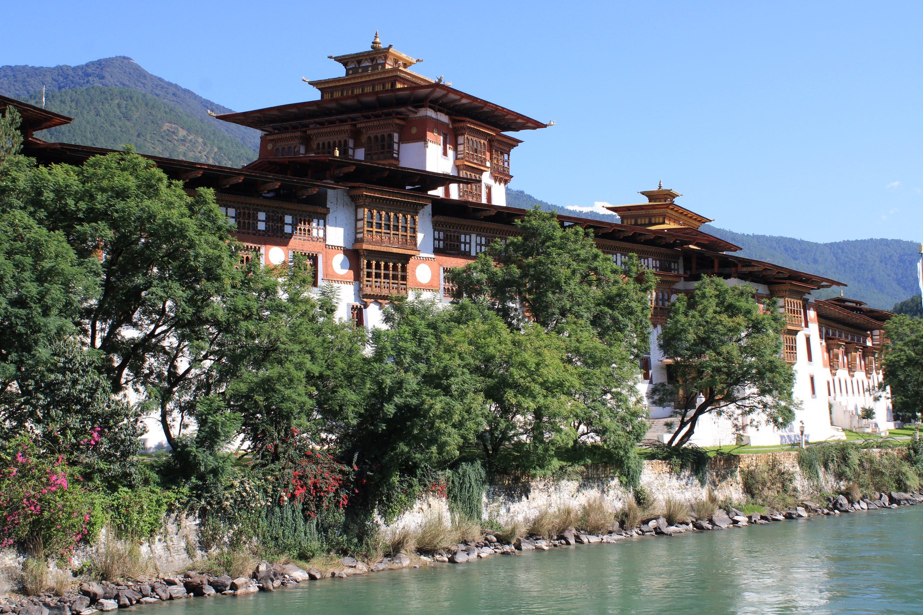
Punakha Dzong has survived fires, floods, and earthquakes, each time rebuilt to original proportions. The dzong contains three interior courtyards: the first handles administration, the second houses monk quarters around a central watchtower (utse), and the innermost shelters the grand assembly hall (kunrey), adorned with fifty-four gilded pillars and intricate Buddhist frescoes.
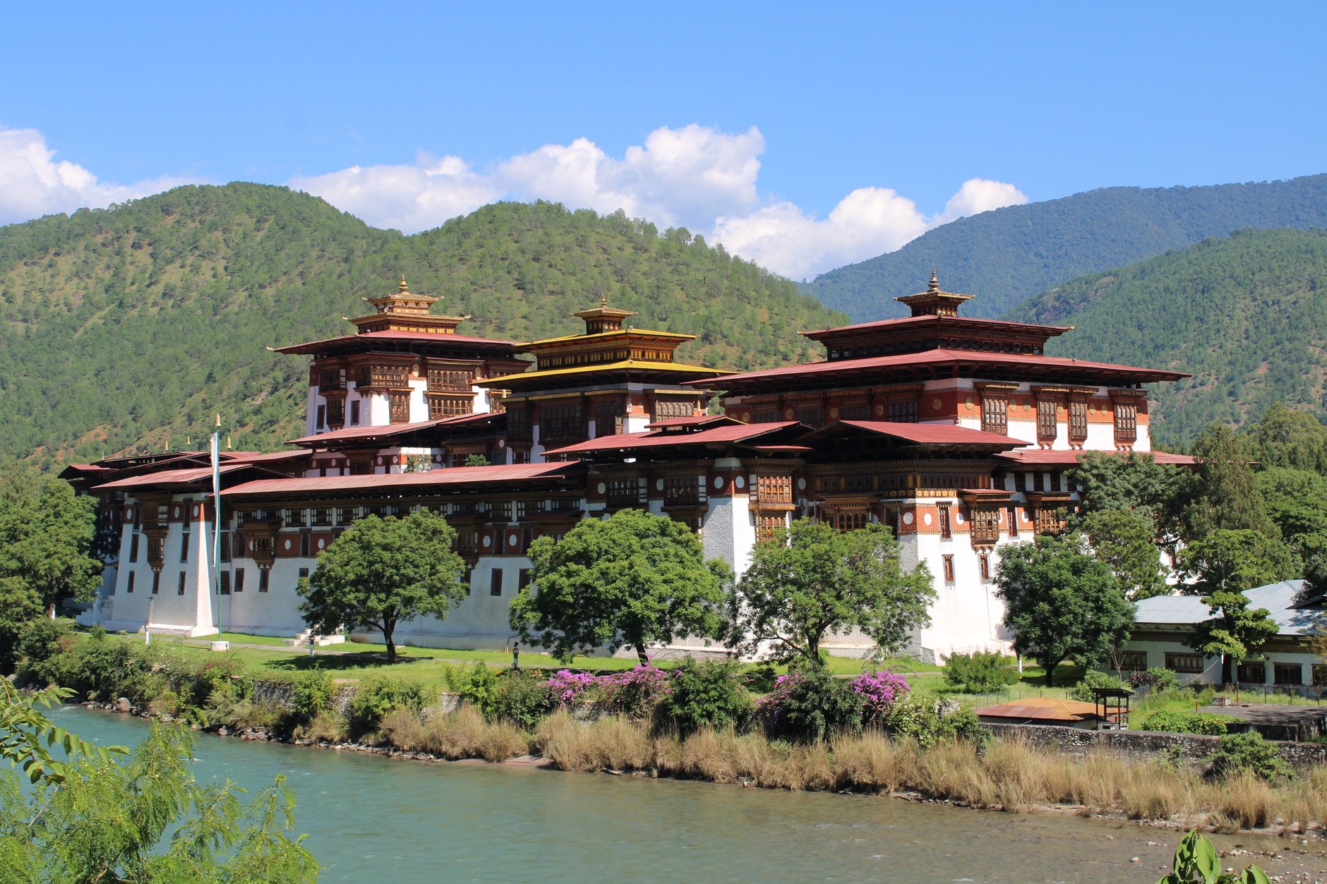
In spring, lavender jacaranda trees blossom along the moat walls, showering purple petals onto whitewashed cobblestones. A short drive up the Pho Chhu valley leads to the Punakha Suspension Bridge, one of the longest pedestrian suspension footbridges in the country, spanning 160 meters across the rushing river canyon to link local agricultural hamlets with the dzong.
The Glacial Sanctuary of Phobjikha Valley
From Punakha, continuing eastward along the lateral highway requires crossing the Black Mountains via the Pele La Pass (3,420 meters) before dropping into the broad, U-shaped glacial valley of Phobjikha (also known as Gangtey). Resting at an elevation of 3,000 meters, Phobjikha is an ecological sanctuary where electrical power lines were deliberately buried underground to preserve unobstructed airspace for migrating wildlife.
Every autumn, hundreds of rare, endangered Black-necked cranes migrate south from the high Tibetan plateau to roost in Phobjikha’s dwarf-bamboo wetlands from late October through mid-February. According to local folklore, the cranes circle Gangtey Monastery three times upon arrival in autumn and repeat the clockwise circumambulation before departing in spring, a ritual viewed by valley residents as a sacred blessing. Overlooking the valley floor stands the sixteenth-century Gangtey Goemba, the primary seat of the Pema Lingpa Nyingma Buddhist tradition, where travelers can embark on the gentle Gangtey Nature Trail through pine woodlands overlooking the marshlands.
Paro Taktsang: The Clifftop Ascent to Tiger’s Nest
The undisputed highlight of any journey to Bhutan is the pilgrimage hike to Paro Taktsang (Tiger’s Nest Monastery). Perched on a sheer vertical granite precipice 900 meters above the floor of the Paro Valley (at an absolute altitude of 3,120 meters / 10,240 feet), the monastery marks the sacred cave where Guru Rinpoche (Padmasambhava) is believed to have flown on the back of a tigress in the eighth century to subdue local demons and introduce Tantric Buddhism to the kingdom.
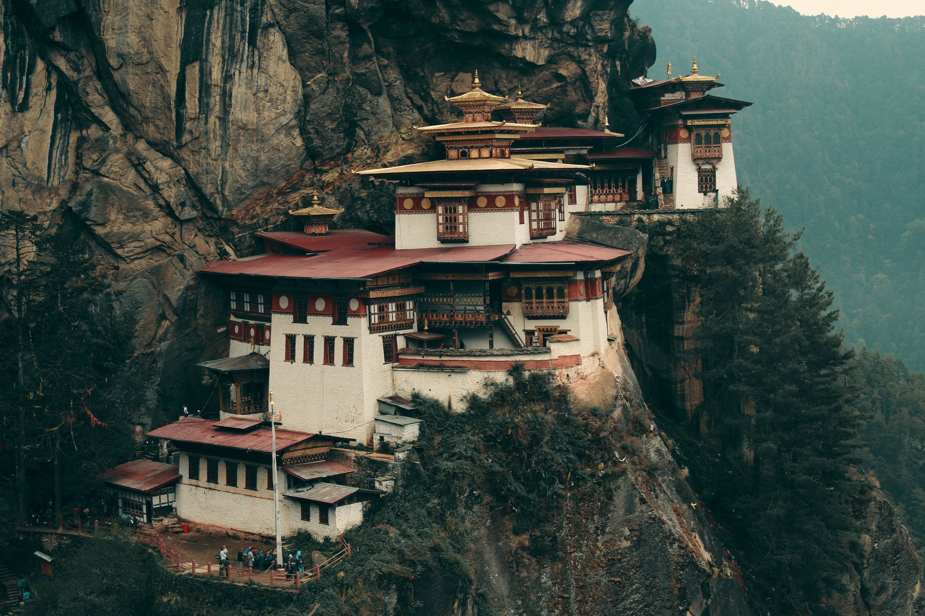
A crucial planning mistake is attempting the Tiger’s Nest hike during your first two days in the country. Climbing over 500 vertical meters on steep, unpaved switchbacks requires cardiovascular acclimatization; placing this ascent at the conclusion of your itinerary (Day 7 or 8) allows your body to adjust to Himalayan altitudes while exploring Thimphu and Punakha. The round-trip hike covers approximately 6.5 kilometers and takes between four and six hours depending on your walking pace.
The trail winds through blue pine and oak draped in moss, passing prayer wheels spun by mountain streams. A halfway cafeteria offers resting benches, butter tea (suja), and ravine views. The final approach descends roughly 700 stone steps into a rock cleft past a waterfall, before climbing the opposite cliff to the entrance.
Strict security regulations apply at the monastery gate: all cameras, smartphones, backpacks, and walking poles must be locked in supervised security lockers before entering the sanctum. Shoes must be removed at temple entrances. Inside the cliff-hewn shrines, butter lamps flicker against gold statues of Guru Rinpoche, while the smell of burning juniper incense fills quiet meditation chambers perched over the abyss.
8-Day Western Bhutan Circuit Itinerary
This balanced eight-day itinerary follows a logical elevation progression: starting in Paro, acclimatizing in Thimphu, descending to subtropical Punakha, exploring high Phobjikha, and culminating with the Tiger’s Nest ascent.
| Day / Stage | Base | Highlights | Transport Mode | Transit Time | Advance Booking Requirement |
|---|---|---|---|---|---|
| Day 1 | Paro to Thimphu | Paro Valley flight arrival, Tachog Lhakhang iron bridge, Thimphu transfer | Private vehicle | 1.5 hours driving | Book visual-approach morning flight months ahead |
| Day 2 | Thimphu | Buddha Dordenma, Zorig Chusum art school, Memorial Chorten, Tashichho Dzong | Private vehicle / walking | Full day exploration | Arrange licensed guide and museum entries |
| Day 3 | Punakha | Dochula Pass 108 Chortens (3,100m), descent to subtropical valley, Chimi Lhakhang | Private vehicle | 3 hours driving | Check Dochula morning mountain visibility |
| Day 4 | Punakha | Punakha Dzong exploration, Mo Chhu river walk, 160m suspension bridge | Private vehicle / walking | Full day exploration | Wear formal temple dress (collars and covered legs) |
| Day 5 | Phobjikha (Gangtey) | Climb Pele La Pass (3,420m), glacial valley, Gangtey Goemba, crane center | Private vehicle | 3 hours driving | Reserve Gangtey lodge well in advance for crane season |
| Day 6 | Paro | Return west over Dochula, Kyichu Lhakhang 7th-century temple, Paro Rinpung Dzong | Private vehicle | 4.5 hours driving | Confirm hotel base in Paro near trail valley |
| Day 7 | Paro | Paro Taktsang (Tiger’s Nest) clifftop pilgrimage hike, traditional hot stone bath | Hiking / private transfer | 5 hours hiking | Reserve evening farm hot stone bath session |
| Day 8 | Paro Departure | Morning departure transfer to Paro Airport for onward international connection | Private vehicle | 25 mins to airport | Confirm visual flight status with airline ground staff |
Field Connectivity and Mobile Data Economics
Telecommunications across Bhutan operate across steep topography. Two national carriers, Bhutan Telecom and TashiCell, provide solid LTE coverage across Paro, Thimphu, and Punakha, and along primary highways. However, deep ravines, passes like Dochula and Pele La, and trekking corridors frequently enter shadow zones without cellular reception.
Understanding data economics is vital for travelers using an NXTL Bhutan eSIM. Because wholesale roaming rates across the Himalayas remain among the highest globally, mobile data on the TashiCell LTE network is billed at $209.65 per gigabyte (approximately $0.21 per megabyte). NXTL operates on a transparent, pay-per-megabyte model against a reusable prepaid balance that never expires, making it ideal for low-bandwidth travel logistics rather than continuous media streaming. Unused credit stays available for later trips across more than 180 countries.
Consider the practical arithmetic: checking an urgent WhatsApp message, loading a short email confirmation, or pinging Google Maps for a coordinate lookup consumes roughly 2 to 5 megabytes, costing around $0.42 to $1.05. A modest allocation of 50 megabytes covers your arrival day coordination at Paro Airport and essential communications for approximately $10.48, completely avoiding the need to queue at airport kiosks or register a physical tourist SIM with passport scans. However, streaming high-definition video or allowing cloud photo backups to run in the background can drain prepaid credit rapidly. The smartest strategy is to keep background data strictly restricted on mobile data, download offline topographic maps before leaving home, and rely on hotel and lodge Wi-Fi networks for high-bandwidth tasks in the evenings.
Currency, Cash, and Daily Financial Realities
The Bhutanese Ngultrum (BTN) is pegged 1:1 to the Indian Rupee (INR). Indian Rupee banknotes in ₹10, ₹20, ₹50, ₹100, and ₹500 denominations are widely accepted legal tender alongside the Ngultrum, though ₹2,000 notes are rejected.
Cash is essential throughout the country. While luxury hotels and established handicraft emporiums in Thimphu and Paro accept major international credit cards (Visa and Mastercard), transactions incur a 3 to 5 percent merchant processing surcharge, and payment terminals frequently drop connection over mountain satellite links. Rural cafes, roadside farm stands, monastery donation boxes, and tips for your driver and guide operate strictly in cash.
Automated teller machines (ATMs) operated by the Bank of Bhutan and Druk PNB are available in Paro and Thimphu, but rural towns like Gangtey lack reliable machines, and urban ATMs regularly run out of cash during national festival (Tshechu) weeks. Arrive with adequate Indian Rupee or US Dollar banknotes in crisp, unmarked condition; US Dollars can be exchanged easily at Paro Airport or banks in Thimphu.
Common Scams and Himalayan Hazards
Bhutan is exceptionally safe, with virtually no street crime, tourist muggings, or violent theft. However, navigating remote Himalayan mountain environments and administrative regulations requires specific vigilance.
- The Premature Tiger’s Nest Ascent: Attempting the grueling 3,120-meter Paro Taktsang hike on Day 2 directly after landing at Paro Airport frequently triggers acute mountain sickness (AMS) and severe physical exhaustion. Always schedule the pilgrimage on Day 7 after five days of acclimatization across Thimphu and Punakha.
- High-Bandwidth Cellular Roaming Bill Shock: Leaving automatic smartphone cloud photo uploads, app updates, or background data active on an international roaming profile at $209.65/GB can consume prepaid balances within minutes. Restrict background data in device settings, and reserve heavy video streaming for lodge Wi-Fi.
- Strict Dzong Dress Codes and Sanctum Device Bans: Entering dzongs or active temples wearing shorts, sleeveless shirts, or hats results in immediate refusal by guard police. Bringing smartphones or cameras past the security checkpoint at Paro Taktsang is strictly illegal; all electronics must remain secured in lockers.
- Monsoon Lateral Highway Landslides: Traveling across mountain passes between Punakha, Trongsa, and Phobjikha during the summer monsoon (July and August) frequently encounters heavy mudslides that close single-track roads for half a day. Always maintain a full day buffer before your international departure flight from Paro.
- The “Centuries-Old Antique” Souvenir Trap: Vendors in Paro bazaar stalls occasionally claim wooden statues, antique thangkas, or bronze singing bowls are authentic historical artifacts. Bhutanese law strictly forbids the export of genuine cultural antiquities, and customs authorities at Paro Airport will confiscate uncertified religious relics without refund.
Slower and Shorter Route Adjustments
If your travel schedule is constrained to five or six days, do not attempt to reach Phobjikha or Central Bhutan. The most rewarding short itinerary focuses exclusively on Paro, Thimphu, and a day excursion over Dochula Pass to Punakha Dzong, before returning to Paro for the Tiger’s Nest ascent. Attempting to drive further east on a tight timeline results in exhausting eight-hour days on winding mountain passes, leaving insufficient time to walk through villages and temples.
With ten to twelve days, expand east into Bumthang, the spiritual heartland. Crossing Yotong La Pass (3,430m) into Bumthang reveals seventh-century temples like Jambay Lhakhang and Kurjey Lhakhang, local cheese dairies, and buckwheat orchards. Hikers can also tackle the three-day Druk Path Trek between Paro and Thimphu past alpine lakes.