El Salvador has undertaken the most dramatic security and tourism transformation in modern Latin American history. Once burdened by decades of civil strife and violent gang territorialism, the smallest nation on the Central American mainland is now one of the safest travel destinations in the Western Hemisphere. Backed by dedicated tourist police (POLITUR), modern highway paving, and an entrepreneurial local hospitality sector, travellers are discovering a compact wonderland of active volcanic calderas, cloud-forest coffee plantations, ancient Maya ruins, and world-class Pacific point breaks.
Because El Salvador covers barely twenty-one thousand square kilometers, you never face twelve-hour travel endurance tests. The true strategic decision for a first-time visitor is selecting basecamps that minimize back-and-forth driving through metropolitan San Salvador traffic. By anchoring a seven-day journey across western El Salvador—splitting your nights between the colonial northern hub of Santa Ana, the cool mountain villages of the Ruta de las Flores, and the black volcanic surf coast of El Tunco—you experience every defining facet of the country within ninety-minute driving radiuses. Here is your definitive operational guide covering volcano summits, crater lakes, coffee harvesting, pupusa gastronomy, and transport logistics.
Trip Planning Blueprint: Shuttles, Currency, and Mountain Driving
Mastering transit and logistics in El Salvador requires understanding three practical realities before arrival:
Transport Options and Road Realities: The main arterial highways connecting San Salvador, Santa Ana, Sonsonate, and the Pacific coast (the modernized CA-1 and Coastal Highway CA-2) are paved multi-lane roads in excellent condition. For independent travellers, renting a vehicle from international agencies at Monseñor Óscar Arnulfo Romero International Airport (SAL) offers maximum flexibility for reaching rural trailheads. If you prefer not to drive, tourist shuttles operated by companies like Tunco Life or Gekko Explorer run daily between major hubs, while private drivers charge sixty to eighty US dollars per transfer. Colorful converted American school buses (known colloquially as *camionetas* or “chicken buses”) connect every village for less than one dollar per ride, though they are slow, crowded, and not recommended when carrying bulky luggage.
Currency and Cash Handling: El Salvador adopted the US Dollar (USD) as its official legal tender in 2001, eliminating currency exchange friction for North American travellers and anyone carrying dollars. While Bitcoin was enacted as co-legal tender in 2021 and select establishments display digital payment codes, ninety-five percent of daily street commerce—including market stalls, family pupuserías, fruit stands, and bus fares—runs strictly on US cash. Bring small denominations: one, five, ten, and twenty-dollar bills in clean condition. Fifty and one-hundred-dollar bills are widely rejected due to counterfeiting concerns.
Volcano Hiking Protocols and POLITUR Escorts: Under Salvadoran national park regulations, scaling Santa Ana Volcano (Ilamatepec) within Cerro Verde National Park requires registered local park guides and accompanying armed tourist police (POLITUR) officers. This system, established decades ago for visitor safety, continues today as standard environmental and safety management. Guided summit ascents depart in coordinated morning groups (typically between 8:30 AM and 10:30 AM), meaning you must arrive at the park entrance gate early to secure your spot.
| Day / Stage | Base | Highlights | Transport Mode | Transit Time | Advance Booking Requirement |
|---|---|---|---|---|---|
| Day 1 | Santa Ana | Arrival at SAL Airport, transfer to Santa Ana, Parque Libertad, neo-Gothic Cathedral | Rental Car / Airport Shuttle | 1 hr 45 mins highway drive | Vehicle pickup / Shuttle seat |
| Day 2 | Santa Ana | Morning guided hike to Santa Ana Volcano acid crater lake, afternoon swim at Lake Coatepeque | Rental Car / Private Driver | 1 hr transfer to trailhead | Cerro Verde park entry group |
| Day 3 | Santa Ana / Ataco | Morning visit to Tazumal Maya ruins, drive up the scenic Ruta de las Flores to Concepción de Ataco | Rental Car / Mountain Road | 1 hr scenic mountain drive | Tazumal museum entry ticket |
| Day 4 | Concepción de Ataco | Highland shade-grown coffee finca tour, artisan textile weaving, evening thermal hot springs | Foot Walking & Short Drive | 20 mins local driving | Coffee finca tasting reservation |
| Day 5 | Juayúa / El Tunco | Hike to Los Chorros de la Calera waterfalls, food tasting stalls, scenic descent to Pacific coast | Rental Car / Shuttle | 1 hr 30 mins coastal descent | Waterfall local guide booking |
| Day 6 | El Tunco (Surf City) | Morning surf lesson on Pacific breaks, relaxing on black volcanic sands, sunset seafood dinner | Local Beach Walking | Walking exploration | Board rental / Surf instructor |
| Day 7 | SAL Airport departure | Morning ocean swim, scenic coastal drive along CA-2 via La Libertad pier, airport departure | Rental Car / Shuttle | 45 mins coastal highway | Flight check-in / Car return |
Days 1–2: Santa Ana: Colonial plazas, Volcanic Acid Lakes, and Sapphire Calderas
After landing at El Salvador’s modern international airport south of San Salvador, bypass the capital’s congested city center and drive directly northwest toward Santa Ana, the country’s second-largest city. Founded in Spanish colonial times and enriched during the 19th-century coffee boom, Santa Ana preserves a handsome historic core centered around Parque Libertad.
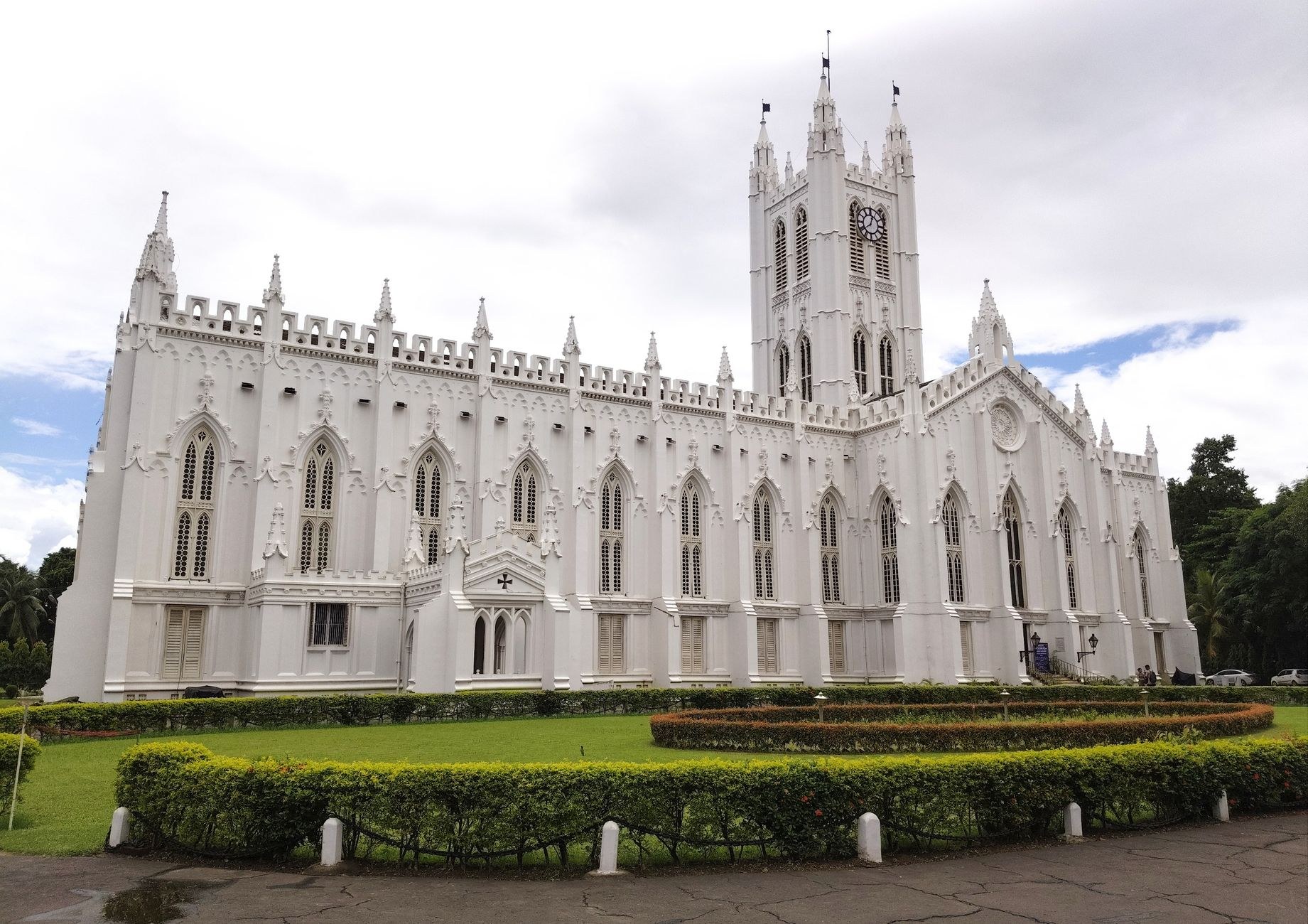
Stroll past the Teatro Nacional de Santa Ana, an opulent Renaissance-style opera house inaugurated in 1910 with ceiling frescoes painted by Italian masters, before stepping inside the grand Cathedral of Our Lady Saint Anne. Constructed in striking white neo-Gothic stone, its soaring spires and cool vaulted nave offer a serene retreat from the afternoon tropical heat.
On your second morning, rise at 6:30 AM to reach Cerro Verde National Park by 8:30 AM for the climb up Santa Ana Volcano (Ilamatepec). Standing at 2,381 meters above sea level, Ilamatepec is El Salvador’s highest and most active volcano, having last erupted in 2005. The trail begins in mossy montane cloud forest before climbing through scrubland and across black volcanic cinder scree along the western ridge.
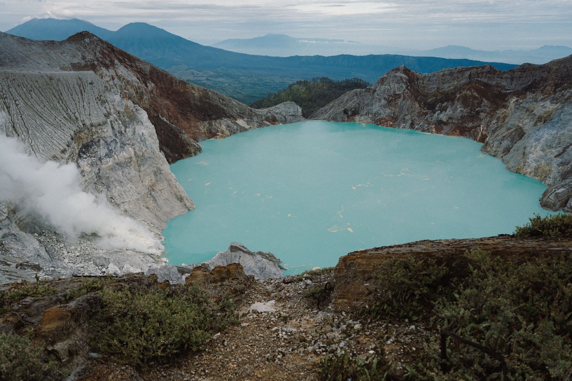
After a steady two-hour ascent, you crest the rim of the immense crater. Looking down over a vertical four-hundred-meter drop, you are met with an astonishing geological spectacle: a boiling, emerald-turquoise acid crater lake venting clouds of pale sulfur steam against dark volcanic basalt. Turn around, and sweeping vistas open across the volcanic cone of Izalco and the sparkling waters of Lake Coatepeque below.
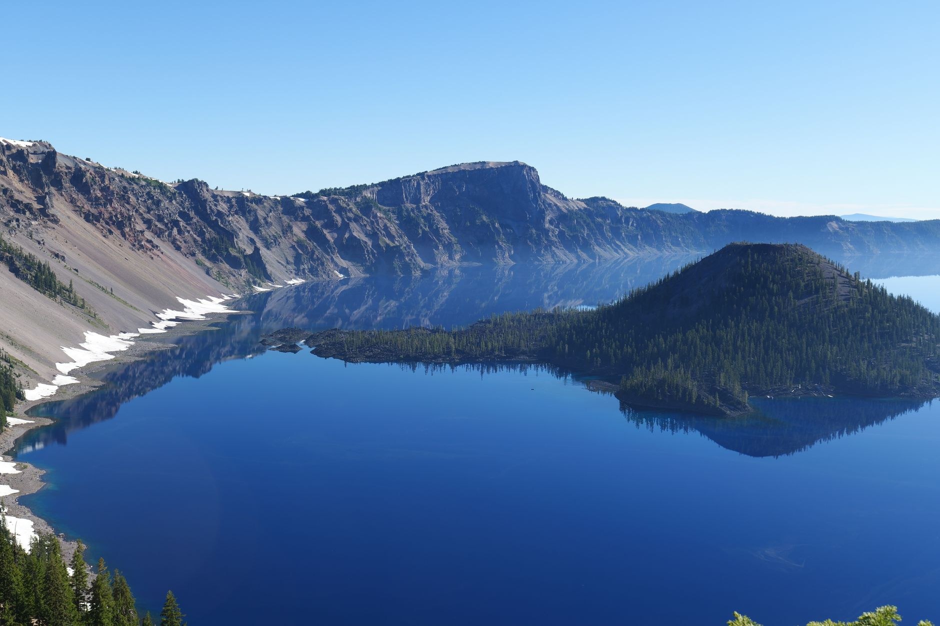
Descend the mountain by early afternoon and drive thirty minutes down to the shore of Lake Coatepeque. Filling a monumental volcanic caldera formed by catastrophic eruptions tens of thousands of years ago, this crystal-clear freshwater lake is surrounded by steep green cliffs. Dine at a lakefront restaurant deck on grilled *mojarra* (whole freshwater tilapia) while enjoying an afternoon swim in the warm, mineral-rich water.
Days 3–4: The Ruta de las Flores: Cobblestones, Murals, and Coffee Highlands
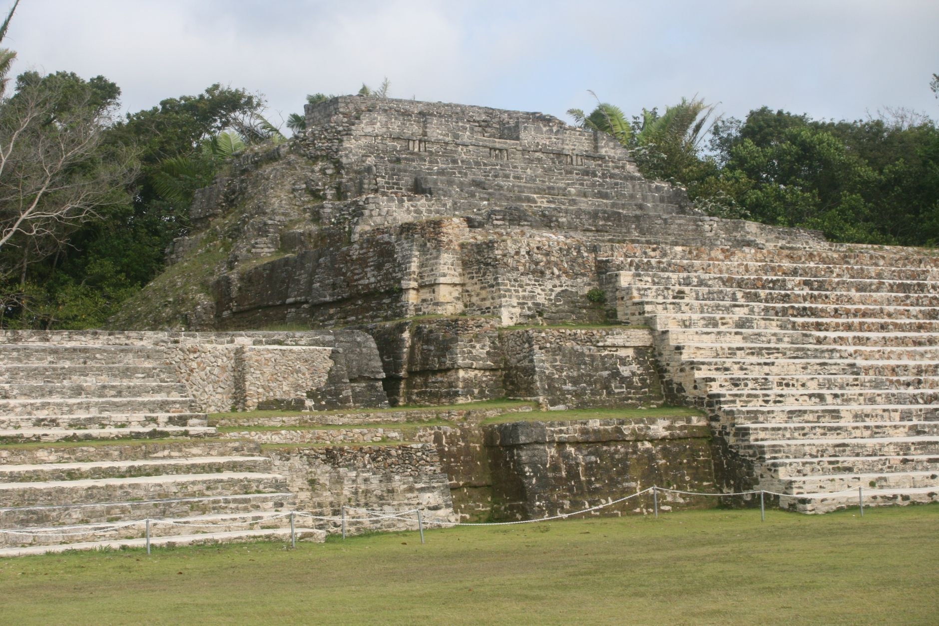
On day three, head southwest toward the Apaneca-Ilamatepec mountain range along the celebrated Ruta de las Flores, a winding mountain road named for the wild seasonal orchids and colorful shrubs blooming along the roadside. En route, make a cultural detour to Chalchuapa to visit Tazumal, the most impressive archaeological complex in El Salvador. Dating from 100 to 1200 AD, Tazumal was a major trade and ceremonial hub linked to the Maya kingdoms of Copán and Kaminaljuyú. Walk among ancient drainage systems, ball courts, and the monumental twenty-four-meter stepped pyramid rising beneath towering shade trees.
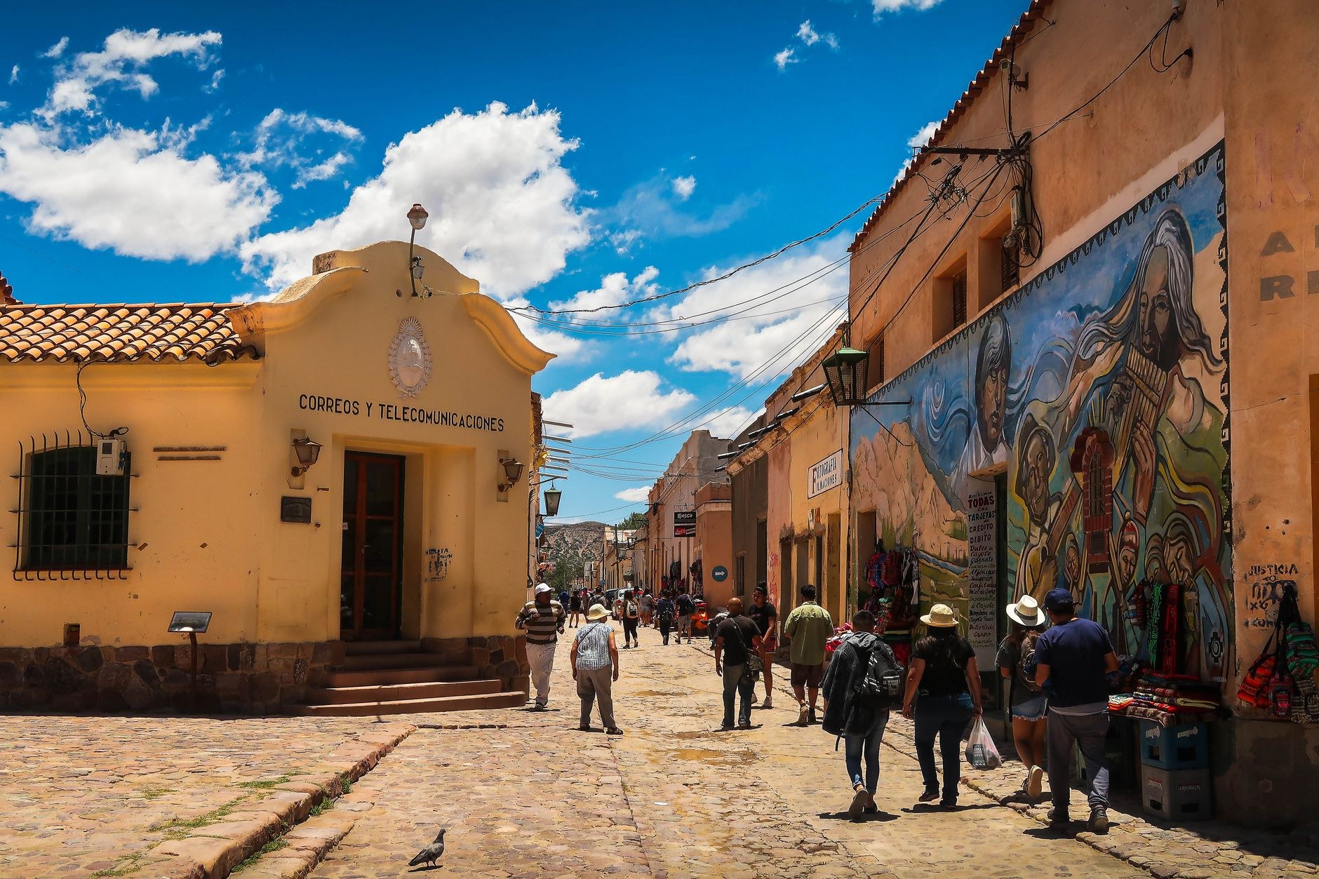
Ascend into the mist-shrouded highlands to Concepción de Ataco, situated at 1,275 meters altitude. Ataco is famous for its expressive street art: almost every whitewashed stucco house along its cobblestone streets is painted with elaborate murals depicting indigenous Pipil traditions, coffee harvests, and folklore legends. Check into a boutique mountain guesthouse with wooden courtyard balconies and log fireplaces, where evening mountain temperatures drop to a comfortable sixteen degrees Celsius. Wander through the workshops of master artisans operating century-old wooden pedal looms (*telares de palanca*), weaving heavy cotton textiles, colorful hammocks, and traditional geometric blankets.
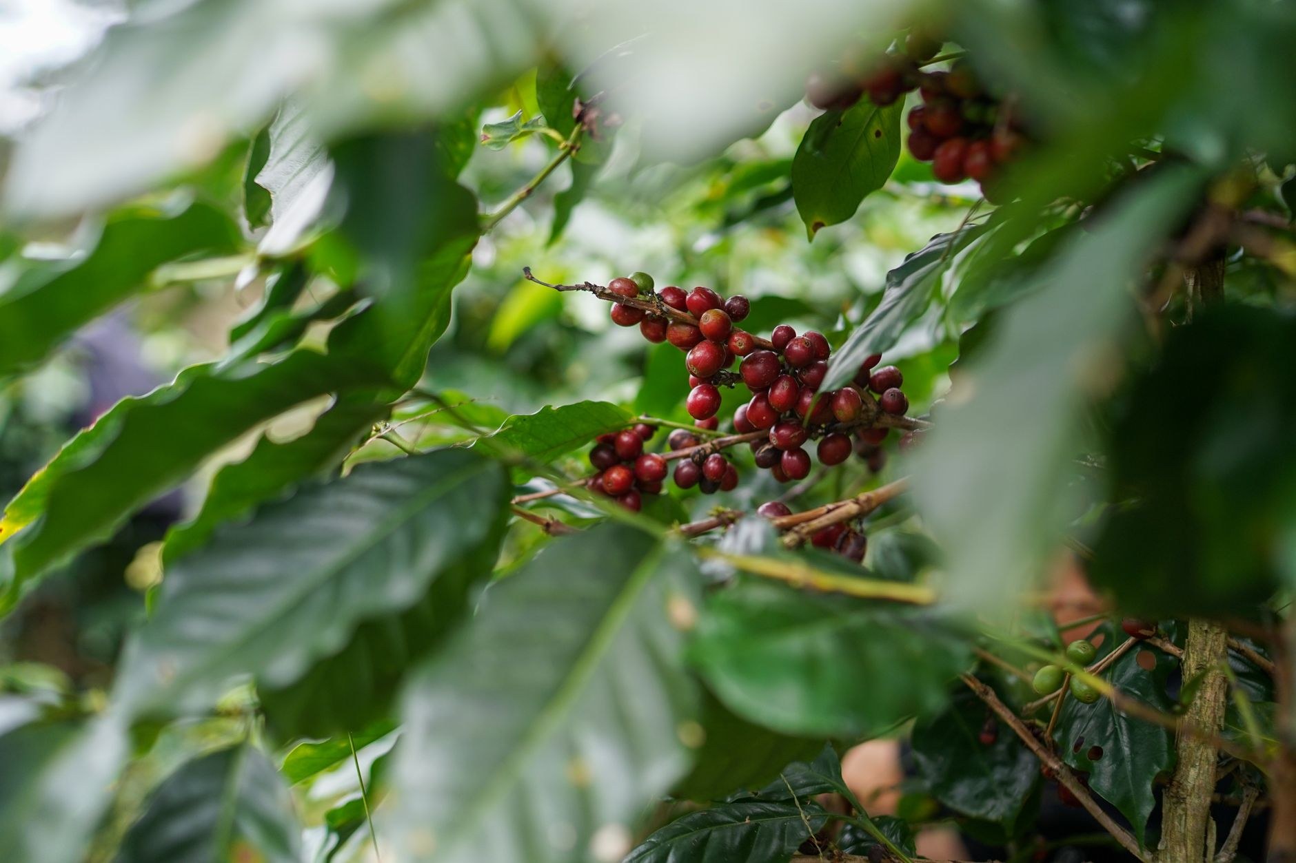
Spend day four touring a historic shade-grown coffee *finca* (such as El Carmen Estate). Walk beneath native shade canopies where heirloom Bourbon and Pacamara coffee varieties thrive in rich volcanic soil at high elevation. Learn how coffee cherries are selectively hand-picked by local pickers, wet-milled in vintage machinery dating to the 1930s, slowly sun-dried on vast brick patios, and cupped by certified Q-graders to evaluate acidity and body. The resulting cups demonstrate extraordinary sweetness, balanced citrus brightness, and deep chocolate undertones. Conclude your afternoon soaking in the natural volcanic mineral pools of Termales de Santa Teresa near Ahuachapán, where natural steam fumaroles heat cascading thermal waters amid tropical jungle foliage.
Day 5: Juayúa Waterfalls and Descent to the Pacific Surf Coast
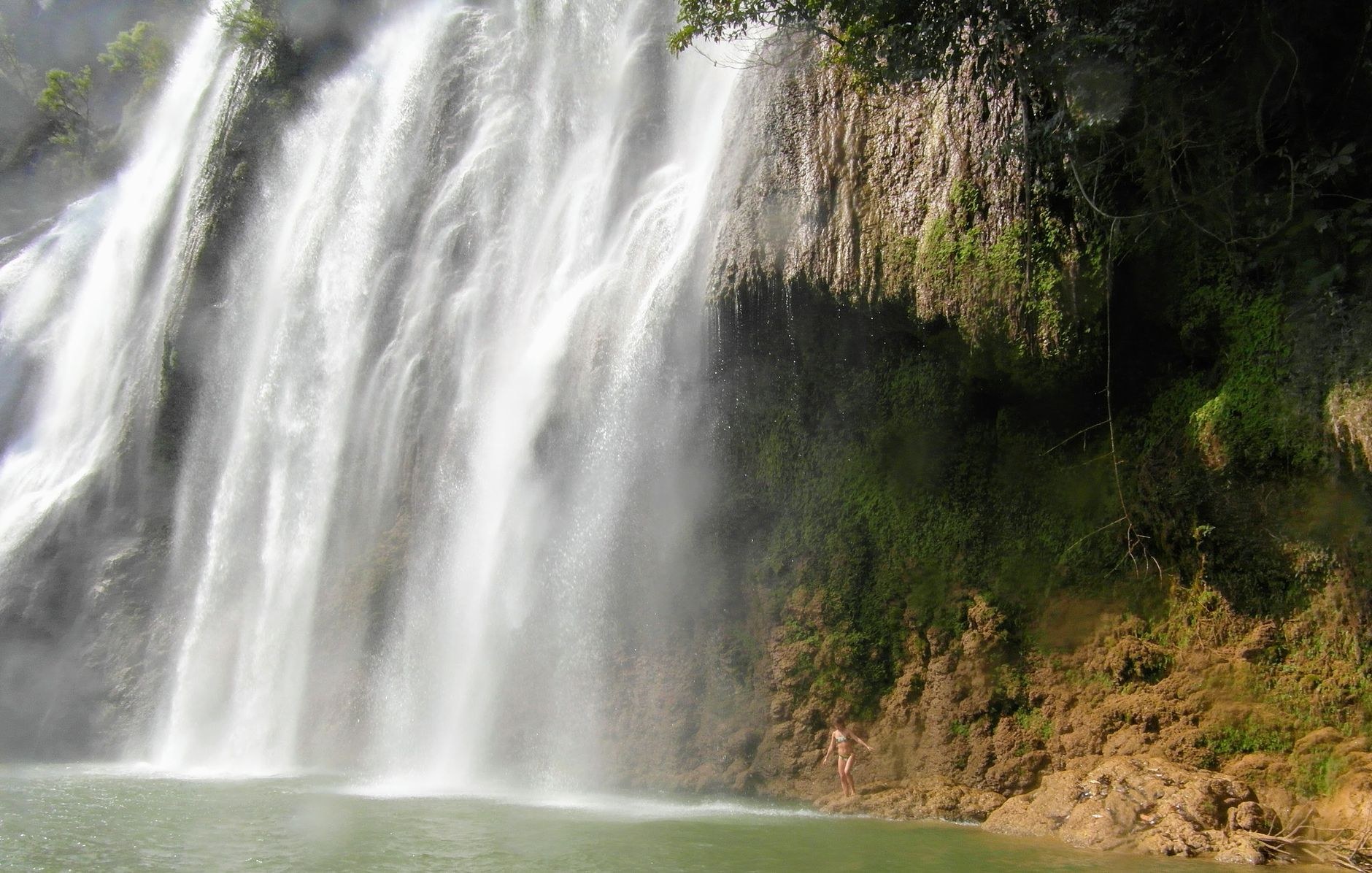
On morning five, drive fifteen minutes east to the lively mountain town of Juayúa. Hire a registered local guide in the central plaza to lead you along the steep canyon trail down to Los Chorros de la Calera, a series of natural freshwater springs that burst directly from fern-clad limestone cliffs into pristine jungle pools. The trail descends through coffee groves and damp tropical gullies before reaching the canyon bottom, where cold, crystal-clear spring water pours through stone tunnels into natural wading basins surrounded by wild banana plants.
If visiting on a Saturday or Sunday, experience Juayúa’s famous weekend *Feria Gastronómica* (food festival), where street vendors set up sizzling charcoal grills throughout the town square, serving skewers of roasted rabbit, grilled chorizo, garlic shrimp, and yucca con chicharrón. After lunch, begin the scenic seventy-minute descent down the mountain highway to the Pacific coastline along the newly developed “Surf City” corridor.
Days 6–7: El Tunco and Surf City: Black Sand and World-Class Breaks
Base your final two nights in El Tunco, a laid-back coastal village renowned worldwide among surfers. Named after a pig-shaped rock formation standing in the crashing surf (*el tunco* is Salvadoran slang for pig), the village features pedestrian dirt paths lined with açai bowls, surf board repair shacks, craft beer bars, and open-air beachfront cafés.
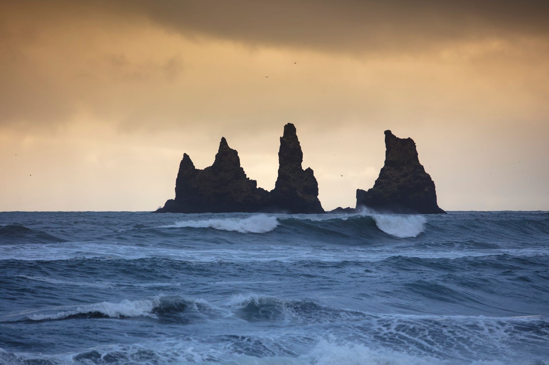
The coastline of La Libertad boasts consistent Pacific groundswells and world-class right-hand point breaks, including Sunzal, Bocana, and nearby El Zonte (affectionately known as “Bitcoin Beach”). Beginners can book private surf lessons with certified local instructors at Sunzal beach, where rolling, forgiving whitewash waves break over sandy bottoms. Experienced surfers can paddle out at dawn to catch peeling six-foot sets off the rocky point, being mindful of submerged cobblestones at low tide.
Spend your final evening watching the Pacific sunset turn the black volcanic sand into a shimmering bronze mirror while listening to live acoustic music at a waterfront palapa. On your final morning, drive along Coastal Highway CA-2 through dramatic sea-cliff tunnels, stopping at the modern fish market pier in Puerto de La Libertad to watch fishermen haul wooden skiffs onto the elevated jetty via motorized pulleys, before heading to the airport for your return flight.
Culinary Heritage: The Art of the Salvadoran Pupusa
No trip to El Salvador is complete without understanding its culinary obsession: the *pupusa*. Declared the national dish by legislative decree, this pre-Columbian staple is celebrated across thousands of neighborhood *pupuserías* marked by glowing neon signs and sizzling griddles.
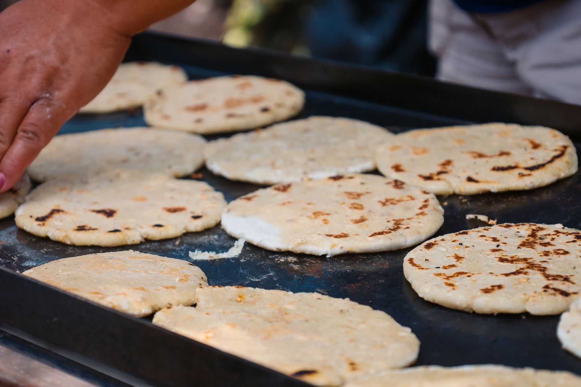
Skilled cooks (*pupuseras*) take balls of freshly ground nixtamalized corn dough (*maíz*) or light rice flour dough (*arroz*), hollow them with their thumbs, fill them generously, seal the edges, and slap them back and forth between their palms with lightning speed before tossing them onto a smoking-hot iron griddle (*comal*).
Order classic fillings: *pupusa revuelta* (a savory blend of refried red beans, melted quesillo cheese, and seasoned ground pork chicharrón), *pupusa de queso con loroco* (melted cheese blended with the aromatic, edible green buds of a native vine), or *frijol con queso*. Always eat pupusas with your fingers—using a fork and knife is considered an unforgivable cultural faux pas. Heap each piping-hot pupusa with homemade *curtido* (crisp, lightly fermented cabbage slaw pickled with carrots, oregano, and vinegar) and drizzle with a spoonful of mild cooked tomato salsa. At eighty cents to one dollar per pupusa, three makes a thoroughly satisfying meal.
Mobile Connectivity and Digital Logistics in El Salvador
Reliable mobile data is invaluable when navigating El Salvador’s mountain highways, searching for hidden waterfall trailheads on Waze, checking ocean swell forecasts on Surfline, and coordinating airport transfers. Mobile telecommunications infrastructure across western El Salvador is solid, with strong 4G LTE signals blanketing Santa Ana, the entire Ruta de las Flores highway, and the Pacific coastline.
Rather than seeking out retail mobile shops in downtown San Salvador or undergoing passport SIM registration queues, configure an eSIM prior to departure. The NXTL El Salvador eSIM connects directly to El Salvador’s primary wireless carriers—Movistar (Telefónica), Tigo, and Claro—delivering dependable 4G LTE coverage across both mountains and coastlines. Priced economically from $3.01 per gigabyte, NXTL utilizes a pay-as-you-go model with no daily data caps. Your balance never expires, meaning remaining data credits remain stored in your digital account for future journeys across 180+ countries.
Travel Scams and Regional Logistics Pitfalls to Avoid
While El Salvador’s modern security climate is welcoming and reassuring, visitors should stay mindful of several common logistical traps:
- Unofficial Volcano Guides at Cerro Verde: At the parking lot of Cerro Verde National Park, unofficial freelance guides often approach arriving cars, claiming that official park tours are fully booked and offering “private express ascents” for fifty US dollars. Decline these offers and walk directly to the official park visitor center to register for the official park guide group for three dollars per person.
- Aggressive Beach Parking Attendants: In popular coastal towns like El Tunco and El Majahual, informal attendants in neon vests wave drivers into public street spaces and demand five to ten dollars in cash for “guarding the car.” Park in secure gated lots operated by established hotels or municipal parking areas with official printed tickets.
- Counterfeit High-Denomination US Currency: When paying for souvenirs or meals with fifty or one-hundred-dollar bills, street vendors may claim they have no change or return counterfeit ten and twenty-dollar bills. Carry five, ten, and twenty-dollar notes exclusively to avoid currency disputes.
- Unmarked Strong Rip Currents: Pacific beaches in El Salvador are prone to powerful undertows and rip currents that can sweep swimmers out past the breaker line within seconds. Never swim alone at unpatrolled beaches, and avoid swimming near rocky rivermouths where outflow currents concentrate.
- Unregulated Highway Rental Vehicle Scratches: Certain local car rental agencies attempt to charge inflated repair deductions upon return for pre-existing undercarriage scrapes sustained on steep mountain tracks. Thoroughly photograph and video all vehicle panels, bumpers, and tires in the presence of the agent during pickup.
By pairing respectful cultural engagement with prepared road logistics and reliable mobile connectivity, your journey through El Salvador will reveal one of Central America’s most dynamic, warm, and rewarding travel frontiers.