Scattered across the turbulent swells of the North Atlantic midway between Scotland, Iceland, and Norway, the eighteen volcanic landmasses of the Faroe Islands form one of the most dramatically sculpted archipelagos in Europe. Basalt sea cliffs plunge sheer into frothing ocean channels, waterfalls cascade directly into the surf, and turf-roofed hamlets sit cupped in glacial amphitheaters. Yet travelling independently across this subpolar Danish self-governing territory demands far more than admiring dramatic coastal views. It requires understanding Atlantic weather volatility, sub-sea tunnel networks, private landowner trail fees, and the absolute necessity of building flexible weather buffer days into your schedule.
The principal error visitors make when planning a Faroese road trip is designing an overly rigid, packed itinerary that treats Arctic conditions like predictable Mediterranean weather. Dense maritime sea fog (*skadda*) can roll in off the Atlantic in ten minutes, dropping visibility to five yards and making clifftop paths lethal. Severe gale-force winds can close high mountain passes and ground regional flights at Vágar Airport for twenty-four hours. A realistic seven-day journey pairs two strategic island bases—the western island of Vágar and the central capital of Tórshavn on Streymoy—while prioritizing flexibility, respecting single-lane tunnel rules, and navigating recent landowner hiking fee regulations. Here is your definitive operational guide to a seven-day subpolar road trip across the Faroe Islands.
Trip Planning Blueprint: Sub-Sea Tunnels, Weather Realities, and Hiking Regulations
Executing an efficient self-drive journey across the Faroes requires mastering four fundamental operational factors:
Sub-Sea Tunnels and Electronic Tolls: The Faroese government has engineered one of the most sophisticated infrastructure networks on Earth, connecting eighty-eight percent of the population via deep underwater tunnels (*tunnil*). Four major sub-sea corridors exist: Vágatunnilin (Vágar to Streymoy), Norðoyatunnilin (Eysturoy to Borðoy/Klaksvík), Eysturoyartunnilin (Streymoy to Eysturoy, featuring the world’s first underwater roundabout), and Sandoyartunnilin (Streymoy to Sandoy). Tunnels operate on automated license-plate recognition cameras. Most rental car companies include an automatic electronic toll transponder, billing crossings directly to your credit card (approximately 100 to 175 DKK each way for Eysturoyartunnilin).
Single-Lane Mountain Tunnel Protocol: While sub-sea tunnels are modern two-lane marvels, older inland tunnels across Borðoy, Kalsoy, and Kunoy are narrow, unlit, single-lane rock corridors bored through mountain ridges. Meeting oncoming traffic requires strict adherence to right-of-way rules: passing bays (*víkiskot*) are carved into the tunnel wall every one hundred yards. The direction facing a passing bay marked with an ‘M’ must pull in to let oncoming traffic pass. If you meet heavy commercial trucks or milk tankers, cars must yield regardless of direction.
Private Landowner Hiking Regulations and Access Fees: Unlike mainland Scandinavia, the Faroe Islands does not practice universal *Allemansrätten* (right to roam). Nearly all rural mountain pastures are privately owned by sheep farmers. To combat trail erosion and protect livestock, mandatory hiking fees and electronic turnstiles have been instituted at famous sites: Trælanípa and Lake Sørvágsvatn (200 DKK per person), Kalsoy Kallur Lighthouse (200 DKK), Saksun lagoon walk (75 DKK), and Villingadalsfjall (200 DKK). Pay via automated contactless terminals at trailheads and remain strictly on marked cairn paths.
The Mandatory Buffer Day Rule: Because North Atlantic storm systems can cancel flights, delay vehicle ferries, and obscure mountain views for an entire afternoon, never pack seven days of mandatory sightseeing into a seven-day trip. Build at least one full unscheduled buffer day into your central stay in Tórshavn. If bad weather grounds you on Day 3, your buffer day absorbs the delay without causing you to miss return flights or pre-booked activities.
| Day / Stage | Base | Highlights | Transport Mode | Transit Time | Advance Booking Requirement |
|---|---|---|---|---|---|
| Day 1 | Vágar (Sørvágur / Miðvágur) | Vágar Airport arrival, car rental pickup, Bøur turf cottages, Gásadalur Múlafossur waterfall | Rental car | 25 mins scenic drive | Rental car pickup at FAE airport |
| Day 2 | Vágar (Sørvágur / Miðvágur) | Trælanípa cliff hike over Lake Sørvágsvatn, Bøsdalafossur waterfall, Geituskorardrangur sea stack | Rental car & hiking | 15 mins transfer to trailhead | Trailhead fee payment (200 DKK) |
| Day 3 | Tórshavn (Streymoy) | Vágatunnilin drive, Vestmanna sea bird cliffs boat tour, Kirkjubøur medieval cathedral, Tórshavn | Rental car & boat tour | 45 mins highway drive | Vestmanna boat tour reservation |
| Day 4 | Tórshavn (Eysturoy / Streymoy) | Eysturoyartunnilin underwater roundabout, Saksun tidal lagoon, Tjørnuvík surf beach | Rental car | 1 hr 15 mins loop drive | Saksun lagoon gate fee (75 DKK) |
| Day 5 | Tórshavn (Northern Isles) | Klaksvík drive, SSL ferry to Kalsoy, hike to Kallur Lighthouse, Kópakonan Seal Woman statue | Rental car, ferry & hiking | 1 hr 30 mins combined transit | SSL Kalsoy ferry timetable coordination |
| Day 6 | Tórshavn (Eysturoy) | Gjógv natural sea gorge, scenic mountain pass below Slættaratindur, Tinganes historic quarter | Rental car & walking | 1 hr scenic mountain drive | Flexible weather buffer day |
| Day 7 | Vágar / Departure | Tórshavn harbor walk, return drive across Vágatunnilin to Vágar Airport, flight departure | Rental car | 45 mins airport transfer | Flight check-in buffer (2.5 hrs) |
Day 1: Arrival on Vágar, Coastal Bøur, and Gásadalur
Your journey begins at Vágar Airport (FAE), constructed by British military engineers during the Second World War on the island’s only flat plateau. Collect your rental car from the terminal desks, ensuring your vehicle is equipped with winter or heavy all-weather tires and an electronic tunnel toll transponder. Rather than rushing straight to the capital, base yourself on Vágar for your first two nights to explore western sea cliffs while daylight and flight energy allow.
Drive west along the fjord shoreline through the village of Bøur. Bøur offers an intimate introduction to vernacular Faroese architecture: black-tarred wooden timber cottages topped with lush green grass turf roofs, huddled beside a narrow pebble beach overlooking the dramatic jagged sea stacks of Tindhólmur. Turf roofs provide practical thermal insulation against damp Atlantic gales, cut from native sod and laid over birch bark sheathing.
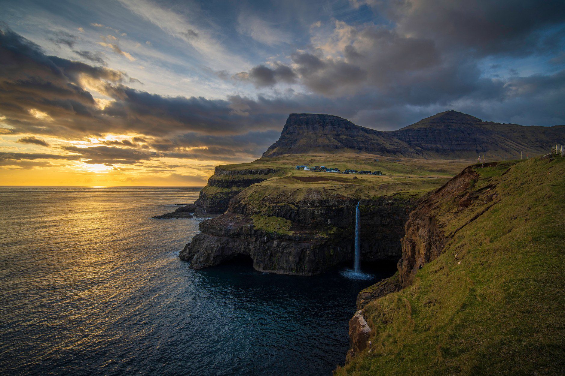
Continue west through the single-lane Gásadalstunnilin, opened in 2004 to connect the once-isolated farming community of Gásadalur to the national road network. Park in the designated visitor lot at the village edge and walk the clifftop trail to the viewpoint overlooking Múlafossur waterfall. Here, a glacial stream plunges thirty meters over vertical dark basalt amphitheaters directly into the roaring Atlantic surf. Watch fulmars and black guillemots ride updrafts along the cliff face before returning to Miðvágur or Sørvágur for dinner.
Day 2: Trælanípa Cliff Hike and Lake Sørvágsvatn
Dedicate your second morning to hiking one of the most geologically striking coastal formations in the North Atlantic: the sea cliffs of Trælanípa and Lake Sørvágsvatn (also known as Leitisvatn). Drive to the trailhead parking lot on the southern outskirts of Miðvágur. Pay the mandatory 200 DKK hiking fee at the gatehouse via credit card before setting off along the established gravel footpath.
The trail traces the eastern shoreline of the lake for approximately three miles across gentle peat moorland. Sørvágsvatn is the largest lake in the Faroe Islands, covering three square kilometers. As you approach the southern coast, the terrain ascends steeply up the grassy slopes of Trælanípa (“Slave Cliff”), an imposing 142-meter vertical basalt precipice where Viking settlers reportedly threw aged enslaved captives into the sea.
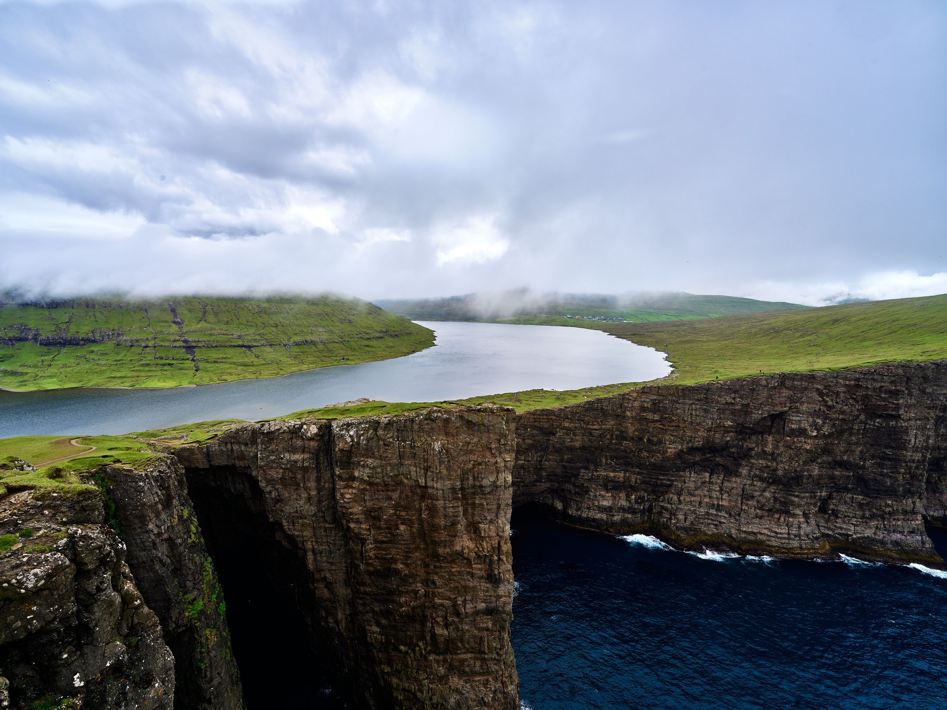
From the crest of Trælanípa, look back inland to witness a famous optical illusion: the lake appears suspended hundreds of feet directly above the open ocean, when in reality it occupies a perched rock basin just thirty meters above sea level. Continue a short distance west to Bøsdalafossur, where the lake’s overflow surges through a basalt fissure directly into the ocean. Return along the same path, mindful that sudden fog can obscure cliff edges rapidly.
Day 3: Vestmanna Bird Cliffs and Medieval Kirkjubøur
Check out of your Vágar accommodation and drive east into Vágatunnilin, the five-kilometer sub-sea tunnel connecting Vágar to Streymoy. Turn north toward Vestmanna to embark on a two-hour boat excursion into the Vestmannabjørgini sea bird cliffs. Small excursion vessels navigate through narrow Atlantic sea gorges, slipping beneath five-hundred-meter vertical rock faces where thousands of kittiwakes, puffins, and razorbills nest on narrow basalt shelves.
After your boat tour, drive south through Streymoy toward Kirkjubøur, the historic ecclesiastical capital of the archipelago during the Middle Ages. Inspect the imposing roofless stone walls of the 14th-century Saint Magnus Cathedral, the whitewashed 12th-century Saint Olav’s Church (still in active parish use), and Roykstovan, a nine-hundred-year-old traditional farmhouse inhabited by seventeen generations of the Patursson family.
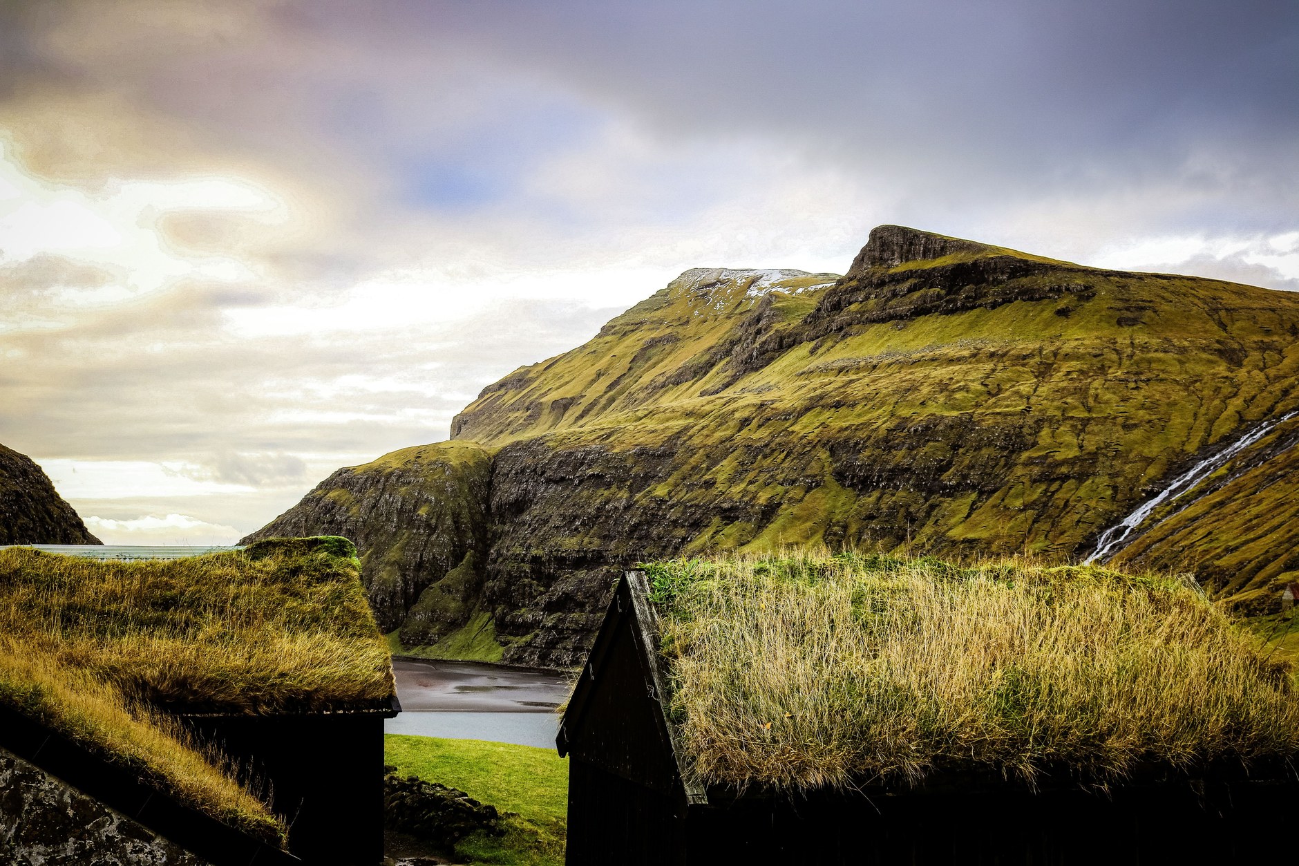
In the late afternoon, drive ten minutes into Tórshavn, one of the smallest capital cities in the world. Check into your hotel or guesthouse, your base for the remainder of the trip. Walk down to the historic harbor district of Tinganes, where red-painted timber government buildings with grass turf roofs have served as the parliamentary meeting site of the Faroese Løgting since Viking times.
Day 4: Saksun Amphitheater, Tidal Lagoon, and Tjørnuvík
Set out for northern Streymoy along Route 53 to the remote settlement of Saksun. The single-lane road winds through a deep glacial valley flanked by waterfalls cascading down sheer amphitheater walls. Saksun was once a natural deep-water harbor until a violent Atlantic storm in the 1600s choked the bay’s entrance with hundreds of tons of sand, turning the harbor into a shallow tidal lagoon.
Visit Saksunar Kirkja, a picturesque stone and turf church consecrated in 1858, and tour Dúvugarðar, an ancient sheep farmstead now operating as a living heritage museum. If visiting at low tide, pay the 75 DKK automated gate fee to walk across the broad expanse of black volcanic sand leading toward the ocean mouth. Always monitor the tide closely, as incoming waters can quickly cut off your return route across the lagoon bed.
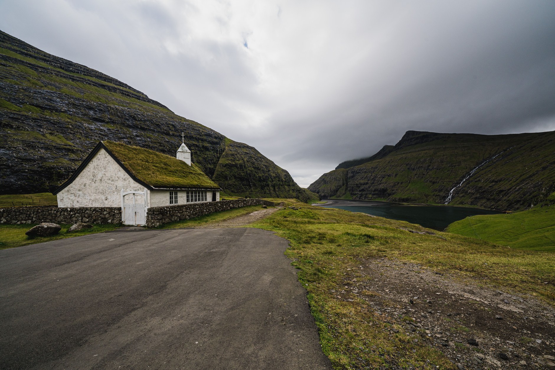
From Saksun, retrace your route and drive north to Tjørnuvík, situated at the terminus of a narrow coastal cul-de-sac. Tjørnuvík features a crescent of black sand favored by hardy cold-water surfers. From the shoreline, gaze across the sound to observe Risin og Kellingin (“The Giant and the Witch”), two dramatic freestanding sea stacks rising over two hundred feet above the waves. Legend holds that two giants attempted to drag the Faroe Islands back to Iceland before the morning sun turned them permanently to stone.
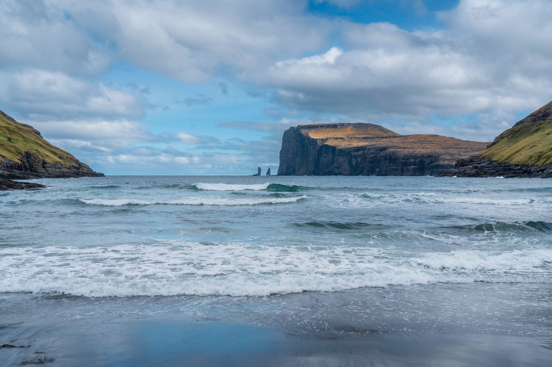
Warm up in Tjørnuvík with fresh waffles and homemade rhubarb jam served in a local resident’s parlor before driving back south to Tórshavn.
Day 5: The Northern Isles and Expedition to Kalsoy
Dedicate day five to the dramatic Northern Isles. Drive east out of Tórshavn into Eysturoyartunnilin, descending beneath the seabed to marvel at the illuminated underwater roundabout featuring sculptures by Faroese artist Tróndur Patursson. Emerge on Eysturoy, cross through Norðoyatunnilin, and arrive in Klaksvík on Borðoy, the fishing capital of the country.
Drive to the ferry quay to catch the Strandfaraskip Landsins (SSL) Route 56 car ferry across to Syðradalur on the long, narrow island of Kalsoy. Note that the small ferry *Sam* accommodates only seventeen vehicles on a first-come, first-served basis. If travelling during peak summer months, park your car in Klaksvík, board as a foot passenger, and catch connecting local bus #506 on Kalsoy.
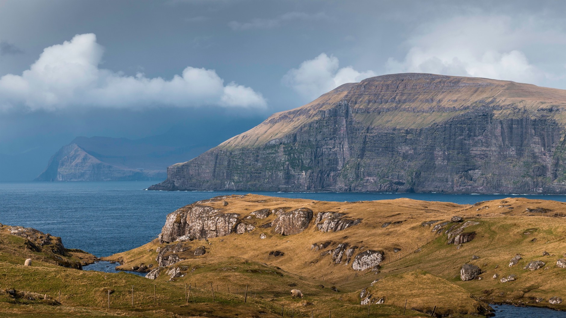
Travel north through Kalsoy’s four single-lane mountain tunnels to the northernmost village of Trøllanes. Pay the 200 DKK hiking fee and begin the forty-minute trek along the grassy coastal ridge toward Kallur Lighthouse. Perched on a knife-edge promontory high above the North Atlantic, the lighthouse stands against towering vertical sea cliffs on neighboring Kunoy and Viðoy.
On your return journey south, stop in Mikladalur to admire the bronze statue of Kópakonan, the mythical Seal Woman from Faroese folklore, standing resiliently on the rocky foreshore amidst crashing breakers. Return to Syðradalur for your afternoon ferry back to Klaksvík and drive back to Tórshavn.
Day 6: Gjógv Natural Harbor and Slættaratindur Passes
Your sixth day serves as a flexible exploration of northern Eysturoy. Drive through the central mountain pass below Slættaratindur, the highest mountain peak in the Faroe Islands at 880 meters. If weather permits, hikers can ascend to the summit in approximately two hours for views spanning all eighteen islands of the archipelago on clear days.
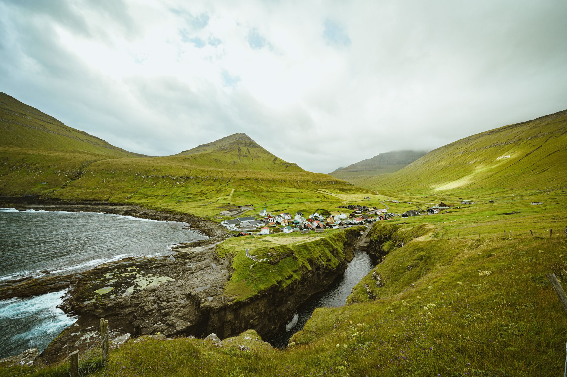
Descend into the charming northern village of Gjógv, named after the two-hundred-meter sea-filled gorge that forms its natural harbor. Walk down the concrete ramp into the cleft to inspect how generations of fishermen winched heavy wooden boats up steep inclines to protect them from Atlantic winter storms. Follow the clifftop footpath north past sea bird colonies and relaxing sheep pastures before heading back to Tórshavn for an evening dinner of fresh Atlantic cod and dry-cured Faroese lamb (*skerpikjøt*).
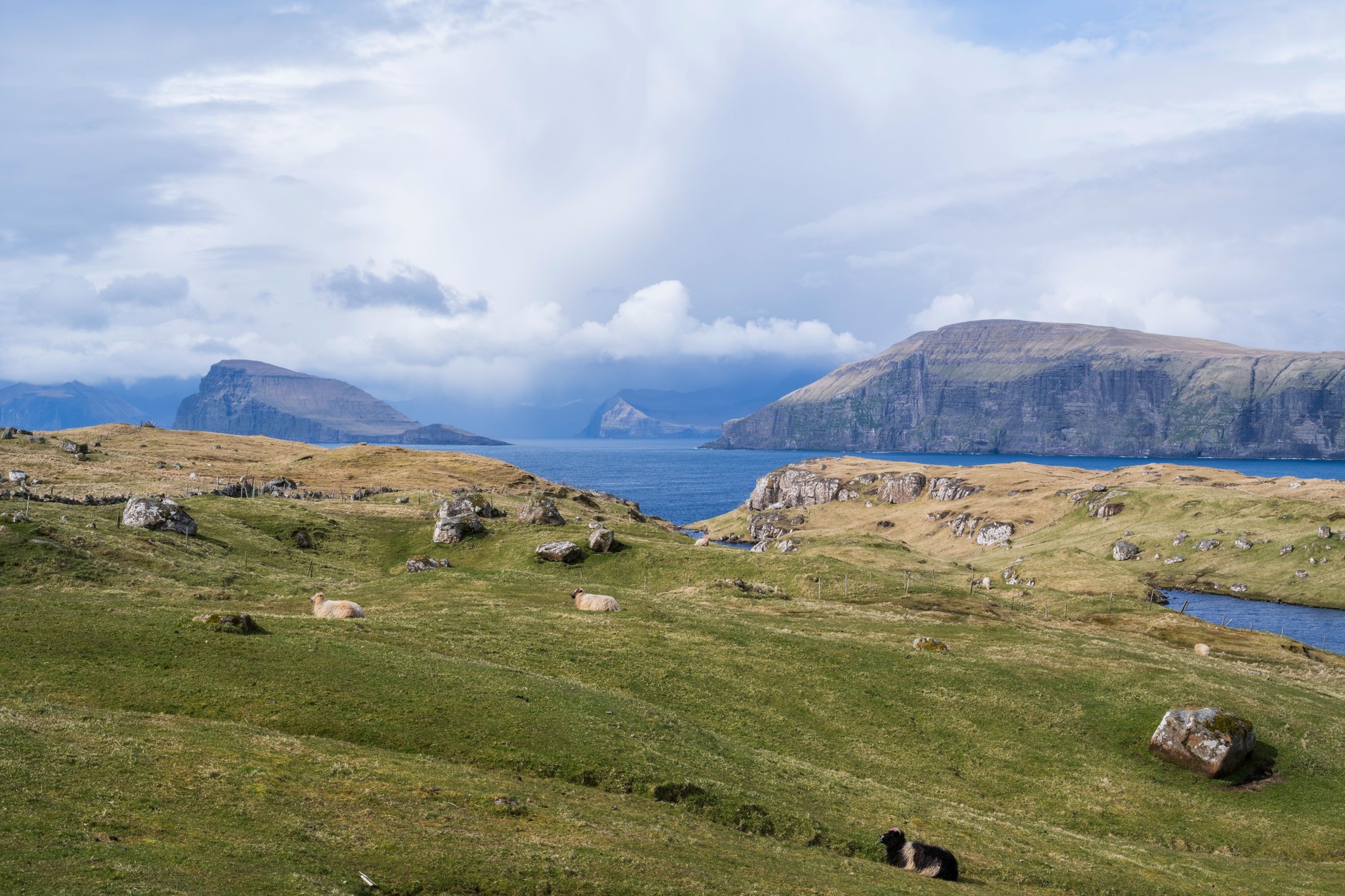
Day 7: Tórshavn Heritage and Airport Departure
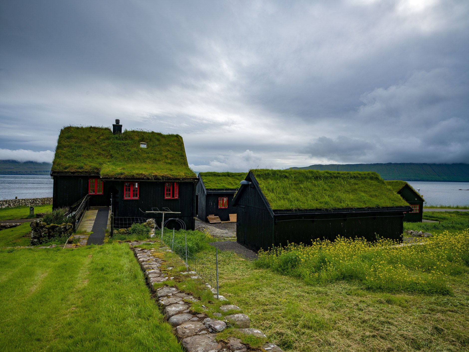
Spend your final morning exploring the old residential quarters of Tórshavn. Stroll through Reyn, an enchanting maze of 16th and 17th-century black-tarred wooden houses with turf roofs, white sash windows, and basalt stone foundations. Stop at local design boutiques along Niels Finsens gøta to admire authentic Faroese wool sweaters and handcrafted maritime crafts.
Check out and begin your forty-five-minute drive back west across Streymoy and through Vágatunnilin to Vágar Airport. Return your rental car, allowing at least two and a half hours before your flight departure. Due to unpredictable North Atlantic weather patterns, flight schedules at Vágar are subject to sudden shifts, making prompt arrival and verified check-in essential.
Mobile Connectivity and Digital Navigation in the Faroe Islands
Having reliable mobile data throughout your Faroese journey is an essential safety and operational requirement. You will rely on active GPS mapping to locate unmarked trailhead gates, live weather radar from the Danish Meteorological Institute (DMI) and Landsverk road webcams to verify mountain pass conditions, automated parking payment apps (such as ParkMan in Tórshavn), and real-time ferry updates from SSL.

Rather than seeking out local telecom shops in Tórshavn, setting up an eSIM prior to departure is the most practical connectivity solution. The NXTL Faroe Islands eSIM connects directly to both Faroese Telecom and Vodafone Faroe Islands networks on fast 5G and LTE frequencies from the moment you step off your plane at Vágar. Operating on pay-as-you-go data at just $2.02 per gigabyte, NXTL eliminates expensive international roaming surcharges. Furthermore, your data balance never expires, keeping remaining credit active for future travels across more than 180 countries.
Travel Scams and Regional Logistics Pitfalls to Avoid
Crime is virtually non-existent in the Faroe Islands, making it one of the safest travel destinations in the world. However, independent travellers face serious environmental, legal, and financial pitfalls:
- The Dense Maritime Fog Cliff-Hiking Hazard: Atlantic fog (*skadda*) can roll in across clifftop trails like Trælanípa or Kallur Lighthouse in under ten minutes, reducing visibility to less than five meters. Hikers who continue walking in dense fog risk fatal falls from sheer sea cliffs. If fog descends, sit down, wait for clear breaks, or follow your GPS breadcrumb trail cautiously away from cliff edges.
- Kalsoy Car Ferry Capacity Bottlenecks: The SSL ferry to Kalsoy accommodates only seventeen vehicles. In summer, queues form hours before departures, and left-behind drivers waste entire mornings on the Klaksvík dock. Avoid bringing a vehicle to Kalsoy: leave your car in Klaksvík, board as a foot passenger, and take the scheduled island bus #506 between ports and trailheads.
- Single-Lane Mountain Tunnel Right-of-Way Errors: Older tunnels on Borðoy and Kalsoy are single-lane with passing bays (*víkiskot*). Failing to yield when the passing bay is on your side causes dangerous head-on blockages inside dark unlit tunnels. Always note passing bay positions and yield immediately to oncoming traffic or heavy milk trucks.
- Bypassing Landowner Hiking Fee Gates: Several iconic hikes (Trælanípa, Saksun lagoon, Kallur) cross private sheep pasture where automated fee turnstiles have been installed. Attempting to bypass turnstiles or climb perimeter fences constitutes trespassing under Faroese law and generates harsh confrontations with local farmers and potential police fines. Always pay required fees via credit card terminals.
- Booking Tight Flight Connections Without Weather Buffers: Atlantic fog and heavy crosswinds frequently cause flight cancellations or diversions at Vágar Airport. Booking onward non-refundable international flights or tight connections on the same day as your departure from Vágar is a major logistical blunder. Always schedule an overnight buffer or allow at least eight hours between your Faroese departure and onward flights.
By respecting subpolar weather rhythms, mastering underwater tunnel tolls and single-lane driving, and maintaining dependable digital navigation, your journey through the Faroe Islands will deliver one of the most astonishing road-trip adventures on Earth.