Few travel mistakes are as expensive or exhausting as attempting to drive Iceland’s entire 1,332-kilometre Ring Road (Route 1) in under ten days. First-time visitors glance at a map, assume an 80 km/h speed limit means an easy circuit, and find themselves driving five to seven hours every day through howling Arctic winds, navigating single-lane gravel detours, and barely having time to step out of the car. Trying to complete the full loop in seven or eight days turns a bucket-list holiday into an endurance rally.
The superior, vastly more rewarding strategy is to focus on a carefully measured 8-day self-drive route that pairs the iconic waterfalls, volcanic black sand beaches, and floating iceberg lagoons of the South Coast with the dramatic fjords, basalt sea cliffs, and volcanic cones of the Snæfellsnes Peninsula. This route keeps daily driving times between two and three hours, allows you to base yourself in scenic countryside lodges for multiple nights, and leaves ample daylight to hike glacial tongues, soak in natural geothermal lagoons, and photograph Arctic landscapes without feeling rushed.
| Day / Stage | Overnight Base | Key Highlights | Transit & Driving Time | Essential Advance Bookings | What to Skip / Save |
|---|---|---|---|---|---|
| Day 1: Stage 1 | Hella or Selfoss | Thingvellir National Park tectonic rift, Strokkur geyser eruptions at Haukadalur, Gullfoss canyon waterfall | Keflavík Airport to Thingvellir to Hella: 210 km (3 hr 15 min total driving) | Rental 4WD SUV with gravel protection; Parka.is automated parking pass at Thingvellir | Skip crowded Blue Lagoon upon landing; save geothermal soaking for Sky Lagoon in Reykjavík |
| Day 2: Stage 2 | Vík í Mýrdal | Seljalandsfoss hidden cavern walk, Skógafoss rainbow plume, Dyrhólaey puffin headland, Reynisfjara black sand beach | Hella to Vík: 90 km (1 hr 15 min driving along paved Route 1) | Skógar Folk Museum ticket; hotel base in Vík (reserve 4–6 months ahead for summer) | Skip walking close to the roaring surf at Reynisfjara; dangerous sneaker waves strike without warning |
| Days 3–4: Stage 3 | Höfn or Skaftafell | Skaftafell glacier hiking, Svartifoss basalt waterfall, Jökulsárlón Glacier Lagoon icebergs, Diamond Beach black sands | Vík to Jökulsárlón: 195 km (2 hr 30 min); Jökulsárlón to Höfn: 80 km (1 hr) | Jökulsárlón zodiac boat tour time slot; certified glacier tongue hiking guide pass | Skip attempting to cross unbridged glacial rivers; stay strictly on paved Route 1 asphalt |
| Days 5–6: Stage 4 | Grundarfjörður or Stykkishólmur | Snæfellsnes Peninsula, Kirkjufell mountain and waterfall, Arnarstapi volcanic sea arches, Djúpalónssandur pebble cove | Höfn to Snæfellsnes: 460 km split over Day 5; Day 6 peninsula circuit: 140 km (2 hr) | Snæfellsnes boutique guesthouse; Vatnshellir 8,000-year-old lava tube cave tour pass | Skip gravel mountain pass F-roads unless driving a certified high-clearance 4×4 with river insurance |
| Days 7–8: Stage 5 | Reykjavík (Downtown 101) | Hallgrímskirkja church tower, Harpa Concert Hall glass facade, Laugavegur boutiques, Sky Lagoon Seven-Step Ritual | Snæfellsnes to Reykjavík: 160 km (2 hr 10 min via Hvalfjörður tunnel Route 1) | Sky Lagoon Pure Pass with Seven-Step Ritual timed slot; Hallgrímskirkja elevator ticket | Skip expensive sit-down tourist dining on Laugavegur; buy road snacks and skyr at Bónus supermarkets |
Audience, Seasonality, and Vehicle Strategy
This 8-day self-drive route is designed for independent road trippers, nature photographers, and adventurous couples who want to experience the best of Iceland’s geological spectacles with complete autonomy. Visiting between June and August provides twenty to twenty-four hours of continuous daylight (the midnight sun), lush green valleys, and active puffin colonies nesting along southern sea cliffs. Visiting in September, October, or March brings crisp sub-arctic air, dramatic golden tundra foliage, and optimal dark night skies to witness the green curtains of the Northern Lights (Aurora Borealis).
Your single most critical upfront logistical decision is vehicle selection. While summer conditions along paved Route 1 permit standard two-wheel-drive sedans, reserving a four-wheel-drive (4WD) SUV is strongly advised year-round. An SUV provides essential ground clearance over loose gravel shoulders, stability against sudden lateral gale-force winds, and superior traction if early snowfall coats mountain passes. Standard credit card collision damage waivers (CDW) categorically exclude gravel chips, blown-out door hinges, and sand/ash damage; purchasing comprehensive gravel and wind protection from your local Icelandic rental operator is essential.
Stage 1: The Golden Circle Gateway (Day 1)
Collect your rental vehicle directly at Keflavík International Airport (KEF) and bypass the city of Reykjavík, pointing your GPS east toward the historic rift valley of Thingvellir National Park (Þingvellir). Here, the North American and Eurasian tectonic plates are actively pulling apart at a rate of two centimeters per year, creating colossal moss-carpeted fissures and canyons. Walk down the dramatic Almannagjá gorge, which served as the outdoor gathering ground for the Althing—the world’s oldest parliamentary assembly, established by Viking chieftains in 930 AD.
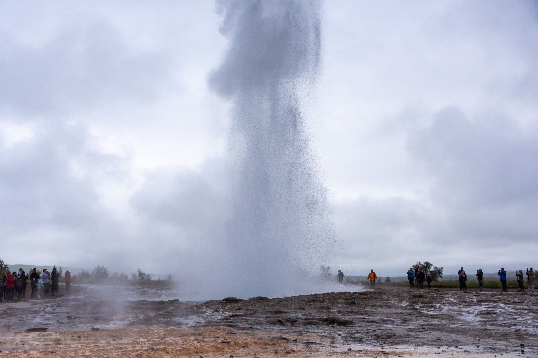
Continue east along Route 37 into the steaming geothermal valley of Haukadalur. While the ancient Great Geysir erupts only rarely today, its volcanic sibling Strokkur reliably shoots a towering 20- to 30-metre plume of boiling water into the sub-arctic air every six to eight minutes. Walk the designated silica paths, watching the turquoise water dome bulge and burst in an instant, surrounded by bubbling mud pools and sulfur vents.
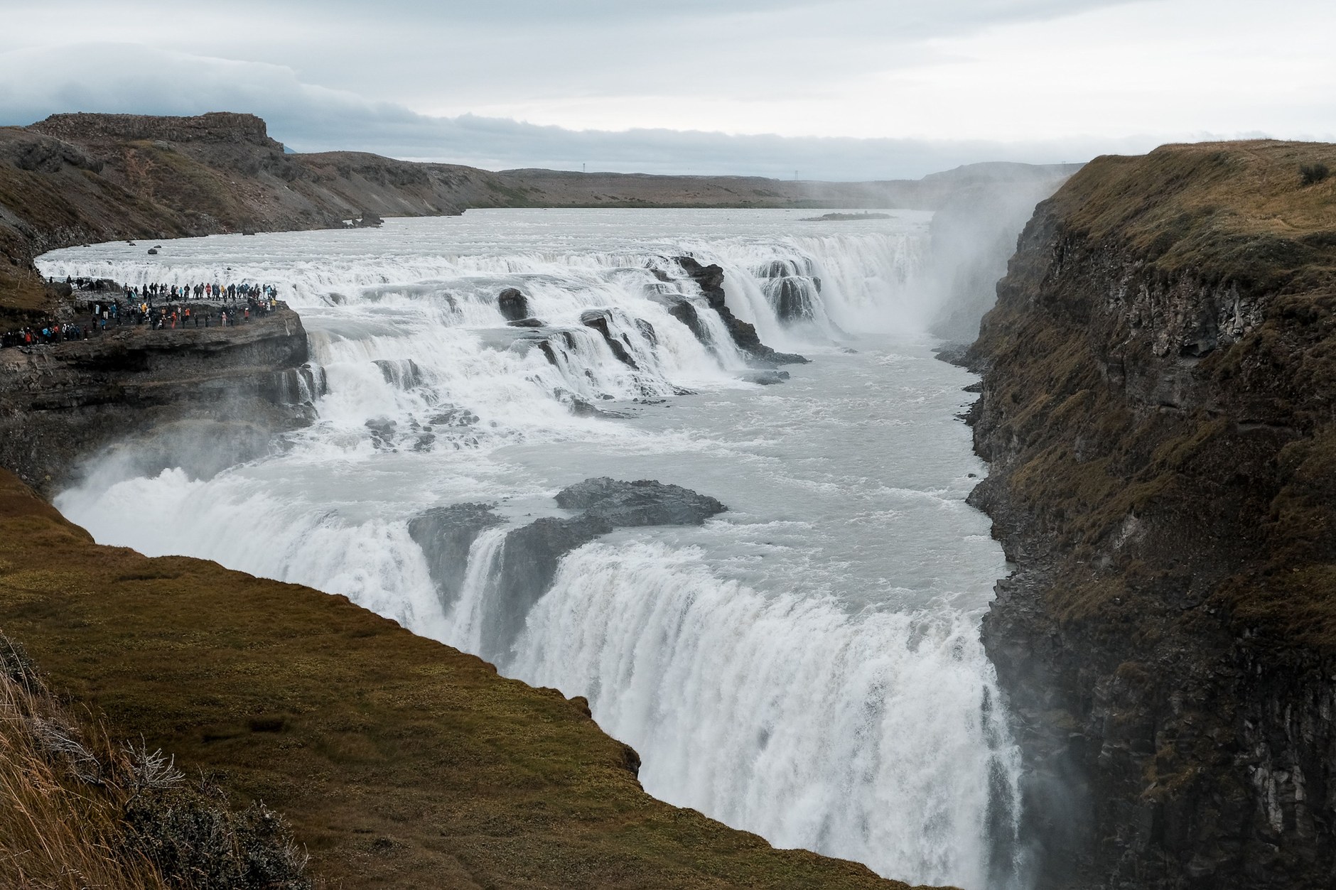
From Haukadalur, drive just ten minutes further east along Route 35 to reach the roaring canyon of Gullfoss (The Golden Falls). Fed by the massive melting ice cap of the Langjökull glacier, the turbulent Hvítá river plunges thirty-two metres across two massive stair-step volcanic terraces into a sheer 70-metre-deep crevasse. The sheer thunder of the falling water reverberates through the canyon walls, throwing up shimmering mist that creates brilliant double rainbows on sunny afternoons.
After touring Gullfoss, descend south through the fertile agricultural heartland of Flúðir and Selfoss to check into your countryside lodge near Hella. Dining at a rural hotel restaurant allows you to sample fresh Arctic char and traditional lamb soup while resting after your transatlantic flight.
Stage 2: The South Coast Waterfalls and Volcanic Beaches (Day 2)
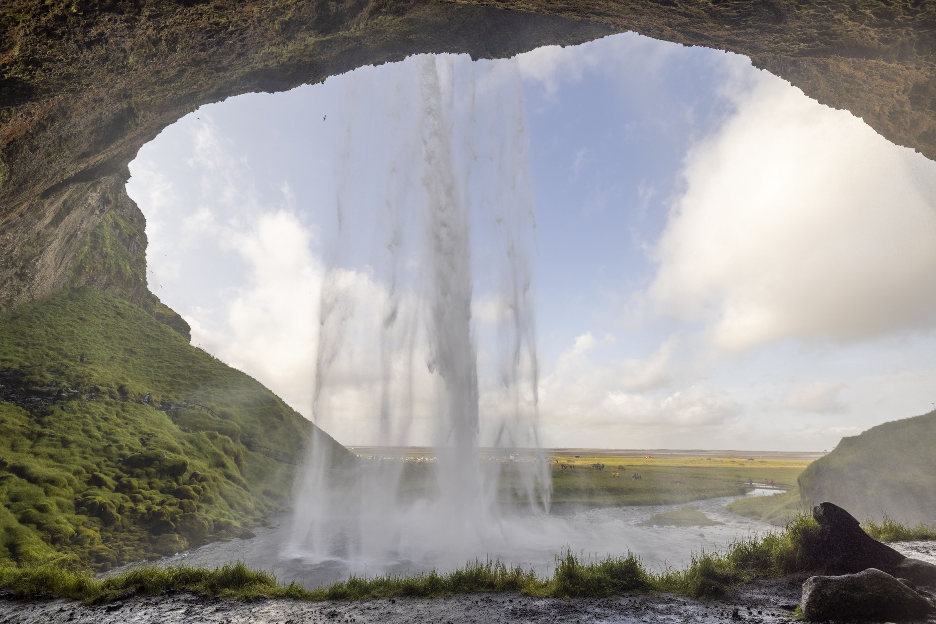
Day 2 delivers the dramatic scenery that has made Iceland famous across the globe. Head east along Route 1, watching the flat agricultural coastal plain give way to sheer basalt cliffs draped in hundreds of ribbon-like waterfalls. Your first stop is Seljalandsfoss, a slender 60-metre waterfall fed by the notorious Eyjafjallajökull volcano glacier. A slick, rocky footpath loops completely behind the cascading sheet of water, allowing you to gaze out at the Atlantic horizon through a translucent curtain of falling spray.
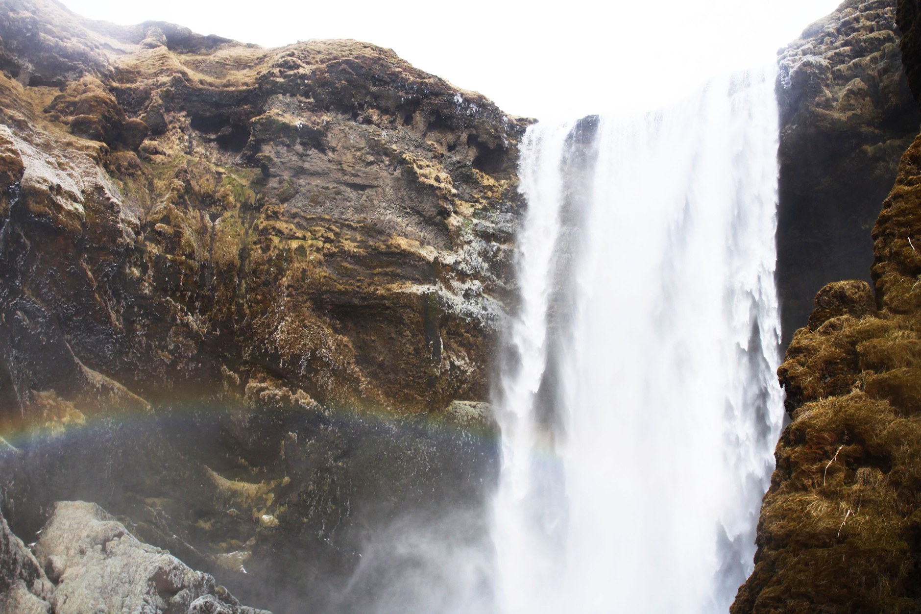
Thirty kilometres further east along the Ring Road stands the colossal wall of Skógafoss. Crashing down from a 60-metre-tall ancient sea cliff, its sheer volume generates a perpetual mist cloud that creates vivid rainbows on sunny mornings. Stand at its base to feel the raw physical vibration of the plunging river, then climb the 527 metal steps alongside the falls to access the trailhead of the famed Fimmvörðuháls pass, where hiking trails wind alongside canyon cascades.
Before arriving in the southern coastal settlement of Vík í Mýrdal, take the coastal detour to Dyrhólaey, a 120-metre volcanic promontory featuring a natural stone arch carved by the surf, where thousands of Atlantic puffins burrow into the grassy clifftops from May through August. Continue down to the world-famous black gravel beach of Reynisfjara, admiring the geometric basalt sea columns of Gardar and the spiky sea stacks of Reynisdrangar rising from the foaming Atlantic breakers.
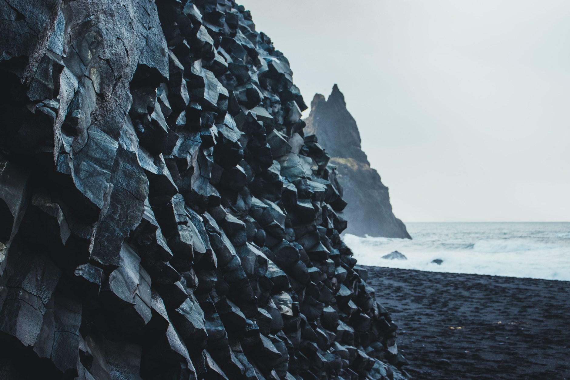
Spend the night in Vík, enjoying a craft beer at the local Smidjan Brugghus and watching the sunset cast long shadows across the black sands of the southern shoreline.
Stage 3: Iceberg Lagoons and Glacial Tongues (Days 3–4)
On Day 3, continue driving east past the moss-covered expanse of the Eldhraun lava field toward Vatnajökull National Park, home to Europe’s largest ice cap. Make an early stop at Skaftafell to take a two-hour guided glacier hike across the crevasse-riddled ice tongue of Falljökull, strapping on crampons and gripping ice axes under the direction of a certified mountain guide.
Forty minutes further east lies Jökulsárlón Glacier Lagoon, where 1,000-year-old icebergs calved from the Breiðamerkurjökull glacier float silently through turquoise waters toward the open ocean. Board an amphibious boat or zodiac tour to cruise between luminous blue, black-striped ice blocks. Across the highway on the black volcanic gravel of Diamond Beach (Breiðamerkursandur), translucent icebergs wash ashore in the pounding surf, glistening like polished jewels against the jet-black sand.
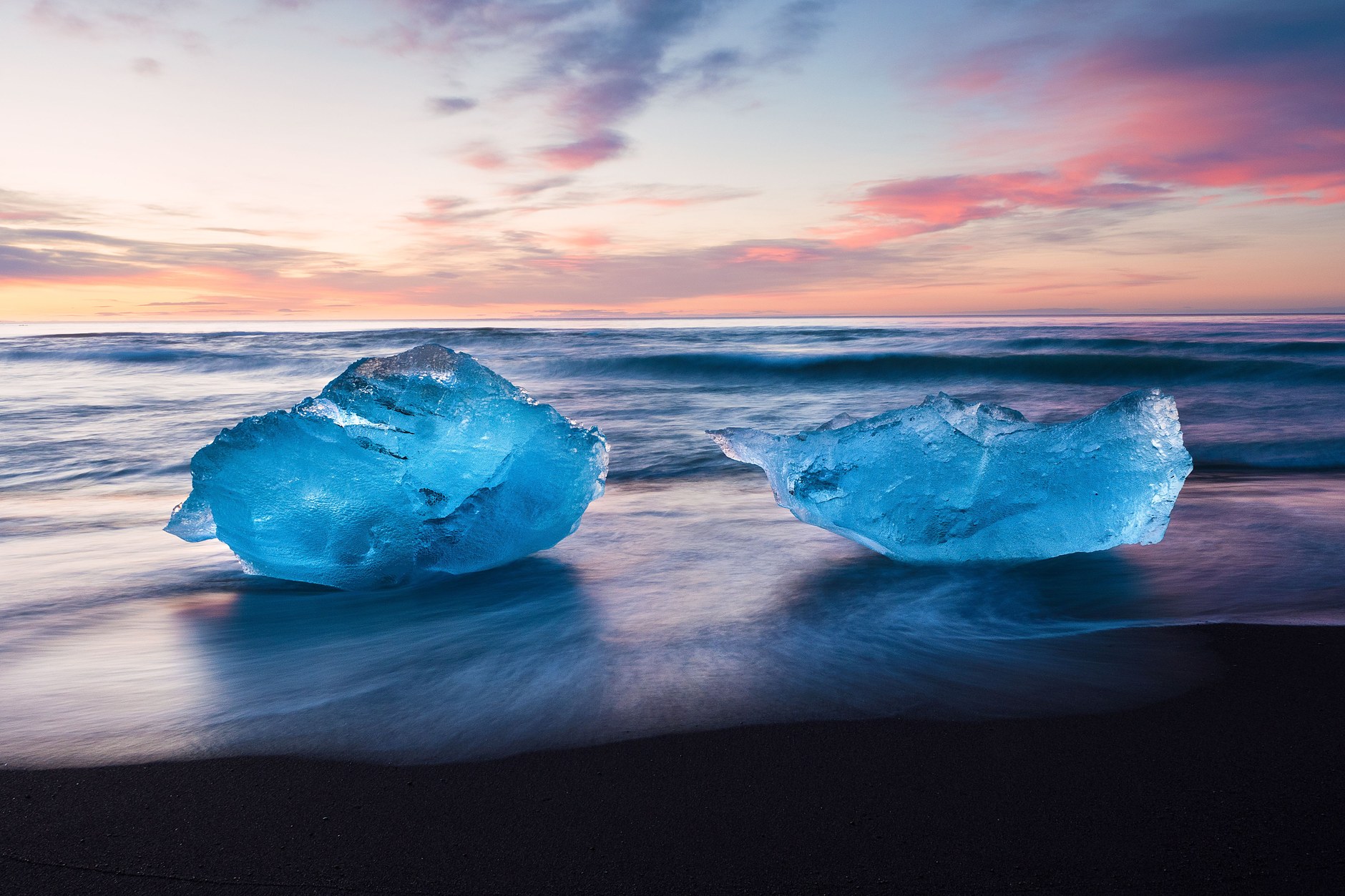
Base yourself in the lobster-fishing port of Höfn for the night, dining on fresh langoustines at Pakkhús restaurant. On Day 4, begin your return journey westward, breaking up the driving with quiet stops at the turf-roofed church of Hofskirkja and the dramatic canyons of Fjaðrárgljúfur.
Stage 4: The Untamed Snæfellsnes Peninsula (Days 5–6)
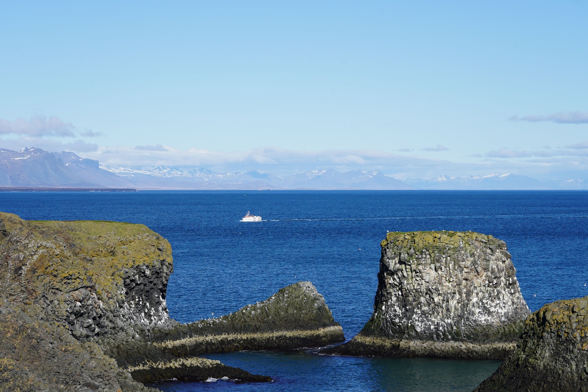
On Day 5, bypass Reykjavík and head north along Route 1, turning west onto Route 54 to reach the Snæfellsnes Peninsula. Known as “Iceland in miniature,” this 90-kilometre-long finger of volcanic land gathers every iconic feature of Icelandic geology into one compact loop: towering volcanic peaks, mossy lava fields, black pebble beaches, yellow sand bays, and dramatic sea cliffs crowned by the gleaming ice cap of the Snæfellsjökull stratovolcano.
Explore the southern shore at Arnarstapi, walking the coastal clifftop footpath past natural basalt sea arches like Gatklettur, where Arctic terns and kittiwakes nest in the rock face. Descend to the black pebble beach of Djúpalónssandur, testing your strength against the historic “lifting stones” used by 19th-century fishermen to qualify for berths on open rowing boats.
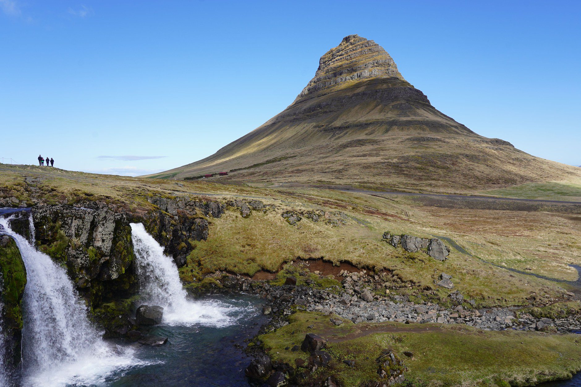
On Day 6, round the western tip of the peninsula to reach Kirkjufell (Church Mountain) outside Grundarfjörður. Rising 463 metres like a standalone pyramid above the sea, its distinctive arrowhead silhouette framed by the twin cascades of Kirkjufellsfoss represents Iceland’s most photographed landmark. Base yourself in the colorful historic fishing village of Stykkishólmur, exploring 19th-century timber merchants’ houses along the harbor.
Stage 5: Reykjavík and Coastal Oceanside Soaks (Days 7–8)
On Day 7, take an easy two-hour drive south through the undersea Hvalfjörður tunnel to Reykjavík. Check into a boutique hotel in the downtown 101 district. Walk up Skólavörðustígur to the iconic 74-metre tower of Hallgrímskirkja church, designed by architect Guðjón Samúelsson to mimic basalt lava columns, and ride the elevator to the clock tower for panoramic views over colorful corrugated iron rooftops and Faxaflói Bay. Tour the geometric glass honeycombs of the Harpa Concert Hall on the harbor promenade.
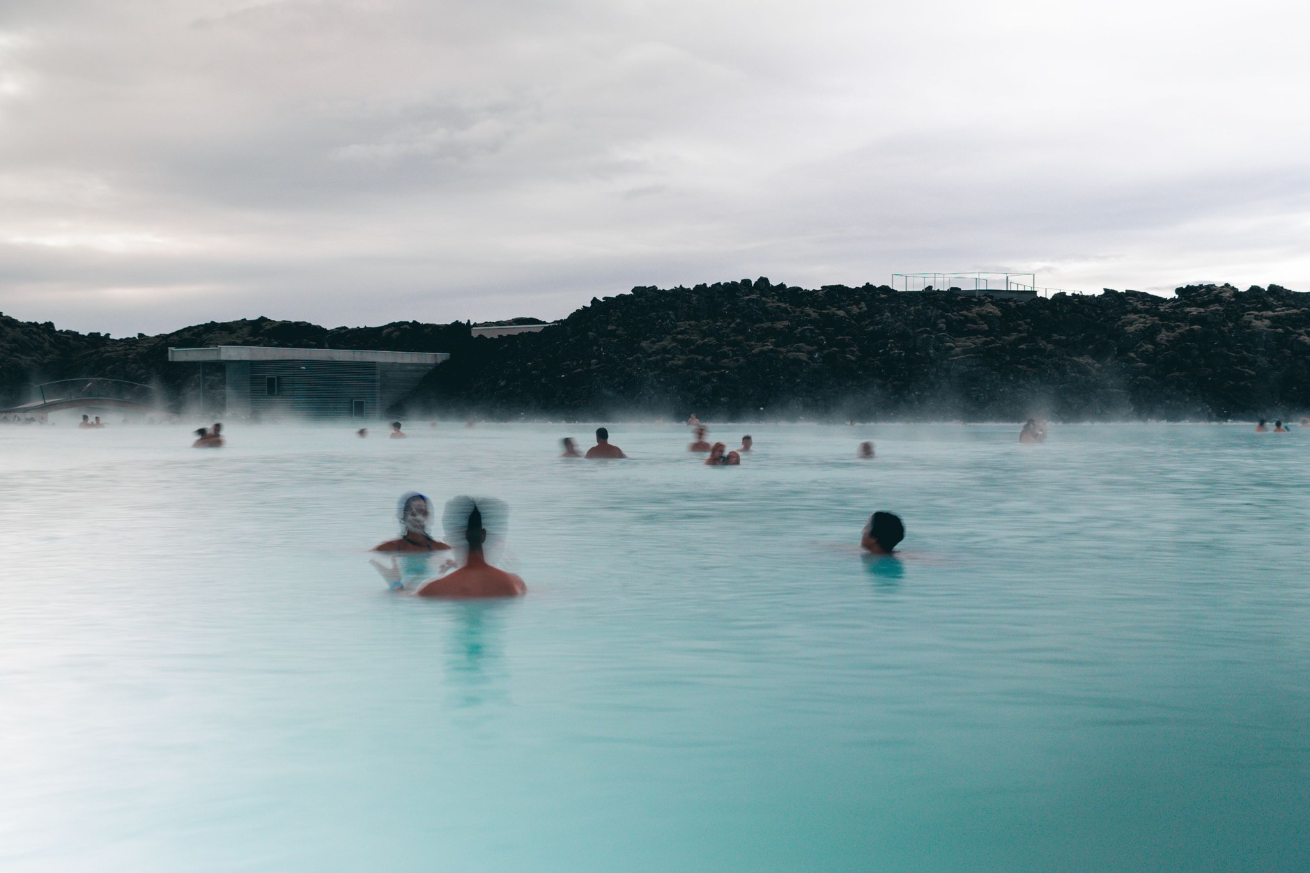
In the late afternoon, head to Kársnes harbor in Kópavogur for the Sky Lagoon. Its geothermal infinity edge blends seamlessly into the cold waters of the North Atlantic Ocean. Complete the traditional Seven-Step Ritual—progressing from the warm geothermal lagoon into a glacier cold plunge, an ocean-view sauna, a cold fog mist chamber, a cleansing body scrub, a steam room, and a warm shower—before enjoying a farewell dinner of Arctic lamb and Icelandic craft beer.
Road Realities: Rental Traps, Sneaker Waves & Hidden Surcharges in Iceland
Iceland is exceptionally safe regarding street crime, but its violent sub-arctic weather, unique road geology, and automated enforcement cameras pose serious financial and physical risks for unprepared drivers. Keep these verified road realities and safety rules at the front of your itinerary:
- The Wind Door Catch (Car Rental Damage Trap – $2.82+ Out of Pocket): North Atlantic coastal wind gusts frequently reach 70 to 110 km/h along the South Coast near Vík and on the exposed Snæfellsnes shoreline. Standard rental collision damage waivers (CDW) strictly exclude damage to door hinges caused by wind. When exiting your vehicle, always park nose-first into the wind so gusts push the door shut, and firmly grip the door handle with both hands before opening. A car door bent backward past its hinges will cost you $2.82 to $5.08 in non-refundable credit card charges.
- The Gas Station Pre-Authorization Hold Trap: Unattended self-service fuel stations across Iceland (N1, Orkan, Olís) operate entirely without human attendants and require a chip-and-4-digit-PIN card. If you insert your card and choose the “Fill Up” (Fella tank) option, the automated system places an immediate pre-authorization hold of a cash sum against your bank account. Filling up three or four times over a week can lock up $903.84+ in pending bank holds for up to ten business days. Avoid this by manually selecting a fixed fuel quantity—such as 5,000 or a cash sum—which charges only that exact sum without a giant hold.
- Reynisfjara “Sneaker Waves” & Lethal Undertows: The Atlantic waves crashing onto Reynisfjara black sand beach do not break in predictable patterns. Deep underwater coastal trenches allow massive surges—known as “sneaker waves”—to roll far up the gently sloping gravel beach with immense speed without visible offshore whitecaps. When the wave retreats, the unstable gravel shelf collapses, sweeping tourists into sub-zero undertows with zero chance of swimming back. Always check the electronic warning lights at the beach entrance (Green: safe; Yellow: stay back; Red: stay behind the cliffline) and never turn your back to the ocean.
- Automated Plate Recognition Parking Surcharges (Parka.is Fines): Parking at major natural landmarks—including Thingvellir National Park, Seljalandsfoss, Skaftafell, Reynisfjara, and Kirkjufell—is monitored by automated number plate recognition (ANPR) cameras rather than physical barrier gates. You must pay the standard parking fee ($5.65 to $7.91) within 24 hours via the Parka.is app or website. If you fail to log payment, the park authority sends the violation notice to your car rental company, which will automatically charge your card the parking fee plus an unavoidable administrative penalty per incident.
- Single-Lane Bridges & Blind Crests (Einbreið Brú & Blindhæð): Outside the capital, Route 1 features dozens of historic single-lane wooden and steel bridges marked with the warning sign Einbreið Brú. The vehicle closest to the bridge has legal right of way; you must slow down, assess oncoming headlights, and yield at the turnout. Furthermore, hilly rural roads feature sharp blind crests marked Blindhæð where oncoming cars cannot be seen until they reach the peak; hug the right side of the road and never overtake near a blind hill.
- The 10-11 Convenience Store Markup Trap: Dining out in Iceland is expensive, but grocery shopping at green-and-white 10-11 convenience stores or highway gas stations will double your food bill. These stores impose markups of 50% to 120% on everyday essentials like skyr, fruit, water, and sandwiches compared to budget supermarket chains. Stock up on breakfast provisions, trail snacks, and thermal coffee supplies exclusively at Bónus (marked by its yellow pig logo) or Krónan. Note that pristine tap water in Iceland is glacier groundwater; buying bottled water in plastic bottles is an expensive tourist tax.
Before turning your ignition key each morning, open two essential safety sites: SafeTravel.is (official search and rescue alerts and road warnings) and Vedur.is (the Icelandic Meteorological Office radar for hourly precipitation, wind force in m/s, and aurora forecasts).
Data Connectivity and Navigation Across Iceland’s Route 1
Reliable mobile internet connectivity is a critical safety requirement when driving outside urban Iceland. Sub-arctic weather conditions shift with startling speed: a clear morning at Skógafoss can turn into an emergency wind advisory or black-ice storm before you reach the mountain pass near Vík. Having continuous cellular data enables live push notifications from SafeTravel.is, real-time weather monitoring on Vedur.is, instant parking payments via Parka.is, and cloud-based GPS rerouting if high winds force highway closures.
Iceland boasts one of the most advanced cellular networks in the world. National operators like Fjarskipti / Vodafone Iceland and Síminn maintain 5G coverage across Reykjavík and comprehensive 4G/LTE coverage along the entire southern coastal Ring Road, across the Snæfellsnes ring, and throughout populated fjord basins. However, relying on traditional home carrier roaming often incurs punitive fees of $11.30 to $16.95 per day, while buying a physical plastic SIM card at Keflavík Airport wastes precious daylight after an overnight flight.
The modern, reliable choice is an NXTL Iceland travel eSIM. Your smartphone connects directly to tier-one carriers like Vodafone Iceland at transparent prepaid rates starting from just $1.21 per gigabyte. There is no physical SIM card swap, no contracts, and your balance never expires: you pay only for the exact bandwidth you consume. Here is an estimate of mobile data consumption for an 8-day self-drive route:
| Travel Style & Usage Profile | Daily Online Activities | 8-Day Total Bandwidth | Estimated Data Cost (@ $1.21/GB) |
|---|---|---|---|
| Light Navigator (Road alerts & parking) |
SafeTravel alerts, Vedur weather checks, Parka.is parking payments, Google Maps navigation, emergency messaging | 3 GB – 5 GB | $3.63 – $6.04 |
| Balanced Road Tripper (Aurora tracking & sharing) |
All navigation, aurora radar monitoring, Instagram photo uploads, trail research, restaurant lookups | 6 GB – 10 GB | $7.25 – $12.09 |
| Heavy Digital Nomad (Remote work & tethering) |
Laptop tethering from countryside lodges, high-res video calls, cloud photo backups, YouTube/Spotify streaming | 12 GB – 18 GB | $14.51 – $21.76 |
Install your NXTL eSIM profile on your phone prior to boarding your flight. When your aircraft touches down at Keflavík Airport, activate your data line to open SafeTravel.is and check live highway wind advisories before you even collect your rental vehicle keys.
Trip Variations: Adjusting for Time and Seasons
If You Have Only 5 or 6 Days
If you have less than a week, do not attempt to visit both the South Coast and Snæfellsnes. Choose the South Coast route: spend two nights exploring the Golden Circle and waterfalls around Hella and Vík, one night near Jökulsárlón Glacier Lagoon, and two nights in Reykjavík. This preserves adequate time to hike glaciers and witness floating icebergs without spending six hours a day behind the wheel.
If You Have 10 to 12 Days
With an extra four days, you can expand this route to complete the full Ring Road circuit (Route 1) safely. Continue northeast beyond Höfn through the dramatic Eastfjords to Seyðisfjörður, explore the surreal geothermal fields and volcanic craters around Lake Mývatn, tour the roaring gorge of Dettifoss (Europe’s most powerful waterfall), and spend two nights in Akureyri, the charming northern capital, before rounding the north coast back to Snæfellsnes.
Best Times to Visit
Summer (June to August) delivers 24-hour midnight sun, lush green moss, nesting puffins, and access to highland mountain roads. Autumn (September to October) offers colorful golden tundra, fewer crowds, and the arrival of the Northern Lights. Winter (November to March) brings snowy volcanic landscapes, ice cave tours beneath Vatnajökull, and long dark nights for aurora viewing, though driving requires winter road experience, studded tires, and constant vigilance against gale-force wind closures.