Northern Pakistan presents one of the most awe-inspiring mountain landscapes on Earth, where the planet’s three greatest mountain systems—the Himalayas, the Karakoram, and the Hindu Kush—collide in a tectonic knot of glaciated summits, granite spires, and deep desert gorges. The territory contains five of the world’s fourteen peaks exceeding eight thousand metres, including K2 and Nanga Parbat. Yet, first-time visitors frequently approach Pakistan with unrealistic logistical assumptions, attempting to squeeze ancient Indus valley civilizations in Sindh, Mughal monuments in Lahore, and remote mountain valleys of Gilgit-Baltistan into a single two-week trip, resulting in exhausting domestic transit marathons.
This nine-day high-mountain itinerary is designed specifically for adventurous, culturally respectful travellers visiting during the prime late spring through autumn season (May to October). Rather than attempting an impossible nationwide traverse, the route focuses on the Karakoram Highway (KKH) corridor through Gilgit-Baltistan and the legendary Hunza Valley. Anchoring around three primary bases—capital Islamabad, central Hunza (Karimabad), and upper Hunza (Passu)—this route combines ancient Silk Road stone fortresses, turquoise landslide lakes, and high-altitude border passes without overwhelming travel fatigue.
| Day / Stage | Overnight Base | Key Highlights | Transit & Route Logistics | Essential Advance Bookings | What to Cut / Save |
|---|---|---|---|---|---|
| Days 1–2: Capital Modernism & Pindi Bazaars | Islamabad (F-6 / F-7) | Faisal Mosque, Margalla Hills viewpoint, Rawalpindi Raja Bazaar, truck art workshops, Pakistan Monument | Private vehicle or Careem/Indrive rideshare within Islamabad and Rawalpindi | Islamabad hotel reservation; airport pickup coordination; e-Visa paperwork copies | Skip chaotic public city wagons; use reliable app-based transport for city hops |
| Day 3: Flight or Overland Drive to Gilgit | Gilgit (Karakoram Highway) | Scenic mountain flight past Nanga Parbat (or overland drive via Babusar Pass), Three Mountain Ranges junction | PIA flight from Islamabad to Gilgit (1 hr) or 4×4 overland drive via KKH/Babusar (12 hr contingency) | Early morning PIA flight booking with flexible overland 4×4 backup contingency | Never book tight same-day connections; mountain flights depend strictly on clear weather |
| Days 4–5: Central Hunza & Ancient Fortresses | Karimabad (Hunza Valley) | 800-year-old Baltit Fort, 1,000-year-old Altit Fort, Eagle’s Nest sunset view over Rakaposhi, apricot orchards | Private 4×4 northward along the paved KKH from Gilgit to Karimabad (2 hr drive) | Baltit Fort and Altit Fort guided heritage admission; Karimabad valley guesthouse | Avoid rush-hour road crossings; explore Karimabad’s cobbled alleys on foot |
| Days 6–7: Upper Hunza, Attabad Lake & Passu Cones | Passu or Gulmit | Attabad Lake boat crossing, Passu Cones granite spires, Passu suspension bridge, Borith Lake hike | Private 4×4 through KKH tunnels; chartered wooden boat across Attabad Lake | Attabad Lake boat charter; local Wakhi guesthouse homestay in Gulmit or Passu | Skip speeding through KKH tunnels; stop at lake overlooks for mountain panoramas |
| Day 8: High Khunjerab Pass to China Border | Gilgit | Ascending to Khunjerab Pass (4,693m), highest paved international border, Himalayan marmots, return to Gilgit | Private 4×4 round-trip to Khunjerab National Park gate and border, return south to Gilgit (6 hr drive) | Khunjerab National Park conservation entry permit; warm sub-zero clothing | Do not ascend without prior acclimatization in Karimabad (2,400m) to prevent altitude sickness |
| Day 9: Return Flight & International Departure | Departure (ISB) | Morning mountain flight from Gilgit back to Islamabad, souvenir shopping, transfer to Islamabad International Airport | PIA morning flight Gilgit to Islamabad (1 hr); airport highway link to ISB terminal | Buffer evening connection for international departure; luggage check-in allowance | Avoid scheduling international flights on the same afternoon as your mountain flight |
Days 1–2: Islamabad & Rawalpindi — Modernist Capitals & Truck Art Heritage
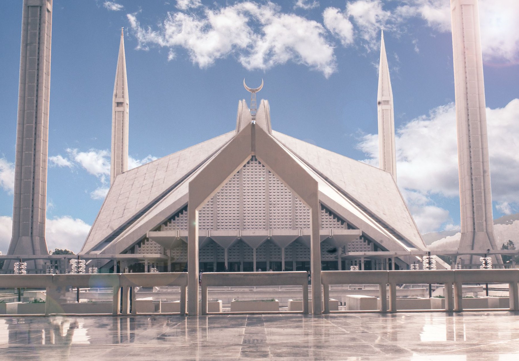
Islamabad presents a striking contrast to the dense historic cities of the subcontinent. Planned in 1960 by Greek urban architect Constantinos Doxiadis as Pakistan’s purpose-built administrative capital, the city is arranged in a disciplined grid of wide, tree-canopied sectors framed by the forested foothills of the Margalla Hills. The urban icon is Faisal Mosque, completed in 1986 through a design by Turkish architect Vedat Dalokay. Abandoning traditional domes and arches, Dalokay conceived the white concrete prayer hall in the shape of an eight-sided Bedouin desert tent, flanked by four pencil-thin, 88-metre Turkish-style minarets soaring into the sky.
Directly adjacent across the highway lies Rawalpindi, an ancient garrison city whose chaotic bazaars offer an immersion into traditional Punjabi commerce. In the narrow alleys of Raja Bazaar, tailors, coppersmiths, and spice merchants trade beneath century-old carved wooden jharokha balconies. Nearby workshops showcase one of Pakistan’s celebrated folk traditions: vehicle decoration, known globally as ‘truck art’.
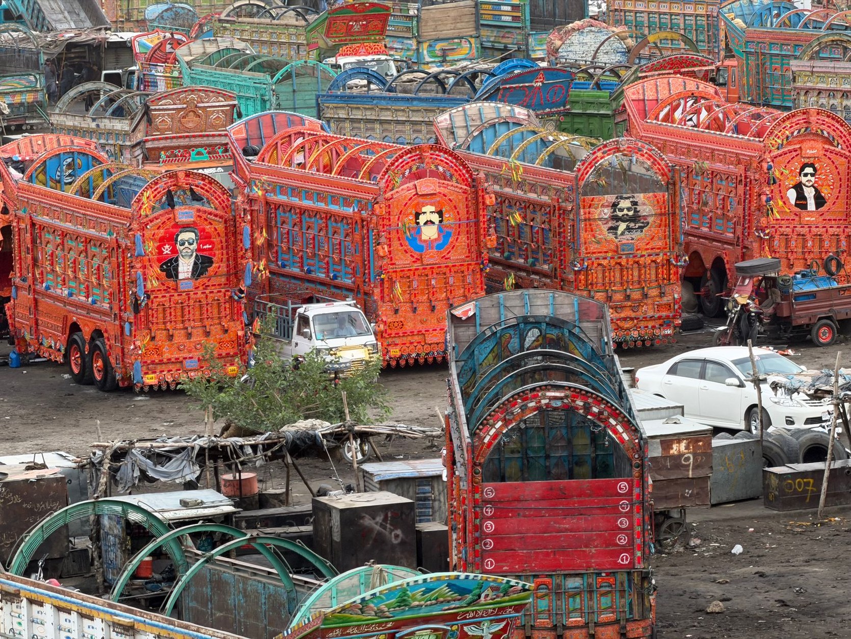
Pakistani truck art transforms Bedford diesel trucks into mobile shrines. Master artisans spend months applying repoussé stainless steel bumpers, hand-painted floral panels, poetic Urdu couplets, and reflective kaleidoscope glass inlays, reflecting a profound visual devotion to craft and road travel.
After sampling charcoal-grilled seekh kebabs and fresh tandoori naan in Rawalpindi, return to Islamabad to rest before your high-altitude transit into the northern ranges.
Day 3: The Karakoram Highway & Junction of Three Giants
On morning three, board an early flight from Islamabad to Gilgit, or embark on the overland route across the Babusar Pass (4,173m). The flight is legendary: on clear mornings, the turboprop aircraft cruises alongside the ice wall of Nanga Parbat (8,126m), known as the ‘Killer Mountain’ for its colossal four-kilometre Rupal Face, the highest rock and ice precipice in the world.
Reaching Gilgit brings you onto the Karakoram Highway (KKH), celebrated as the ‘Eighth Wonder of the World.’ Built jointly by Pakistani and Chinese engineers between 1959 and 1979 across 1,300 kilometres of hostile terrain, the highway traces an ancient branch of the Silk Road through the tectonic boundary where the Indian continental plate crashes beneath the Eurasian plate.
Just south of Gilgit lies a unique geographical point: the Junction of Three Mountain Ranges. Standing on an arid rocky promontory, you look out across the rushing confluence of the Indus and Gilgit rivers to the exact spot where the western end of the Himalayas meets the eastern end of the Hindu Kush and the southern boundary of the Karakoram. From here, the highway climbs north along the Hunza River gorge, where vertical scree slopes rise toward glaciated massifs.
Days 4–5: Central Hunza — 800-Year Fortresses & Terraced Orchards
Driving north into central Hunza, the canyon broadens into the fertile valley of Karimabad (historically known as Baltit), situated beneath the massive, glaciated pyramid of Rakaposhi (7,788m). For centuries, Hunza existed as an isolated, semi-independent mountain kingdom ruled by hereditary monarchs titled the Mir of Hunza. The Burusho people of Hunza speak Burushaski, a linguistic isolate with no known relationship to any other language family on Earth.
Perched high on a rocky bluff commanding the valley stands Baltit Fort, constructed eight centuries ago. Influenced by Tibetan and Ladakhi architectural traditions through the marriage of a Hunza prince to a Balti princess, the fort features multi-story timber-laced stone masonry engineered to absorb violent earthquake tremors. Restored meticulously by the Aga Khan Trust for Culture, its low-ceilinged timber rooms, royal audience halls, and carved wooden window screens (*mushrabiya*) overlook snow-covered peaks.
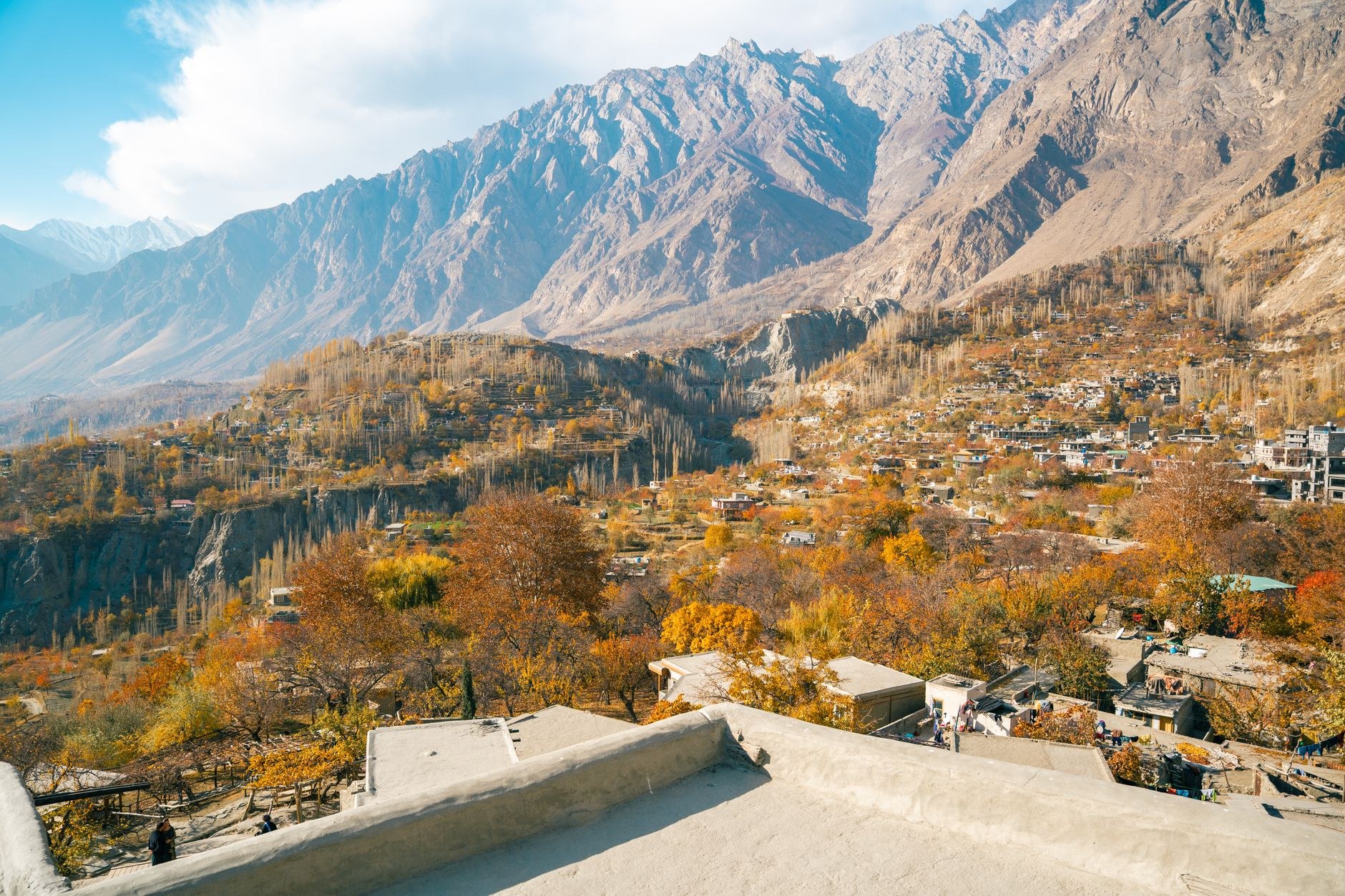
Down the hill stands Altit Fort, dating back over one thousand years, anchored by a defensive watchtower overlooking the sheer gorge of the Hunza River. Surrounding both fortresses are terraced stone fields of wheat, barley, and apricot orchards. In Hunza, agriculture is sustained by gravity-fed stone irrigation canals (*kuhl*) that transport grey glacial meltwater rich in pulverized mineral silt (‘glacial milk’) directly from alpine glaciers to terraced stone plots.

The apricot is the cultural lifeblood of Hunza. In summer, rooftops are carpeted in bright orange drying fruit, which provides food, lamp oil, and vitamin-rich kernels throughout the sub-zero winters. Dine on traditional *chapshuro* (spiced minced meat baked in flatbread) and walnut-apricot cakes before preparing for Upper Hunza.
Days 6–7: Upper Hunza — Attabad Lake & the Passu Cones
Continuing northward along the KKH, you reach Attabad Lake. This luminous turquoise body of water did not exist until January 4, 2010, when a massive mountain slope collapsed into the Hunza River gorge, burying the village of Attabad and severing nineteen kilometres of the Karakoram Highway. The resulting natural rock dam impounded the river, creating a twenty-one-kilometre alpine lake enclosed by sheer granite walls. For five years, all vehicles and goods had to be ferried across the water on wooden barges until Chinese and Pakistani engineers carved five bypass tunnels through solid rock in 2015.
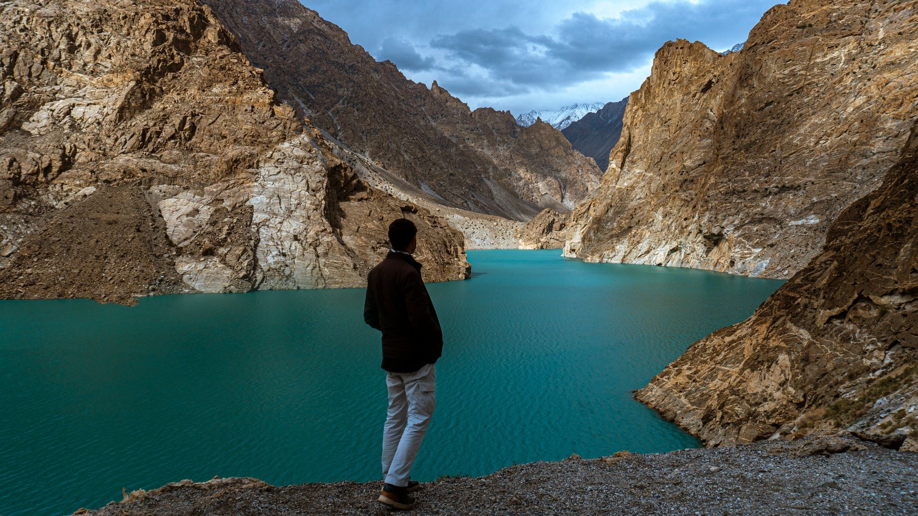
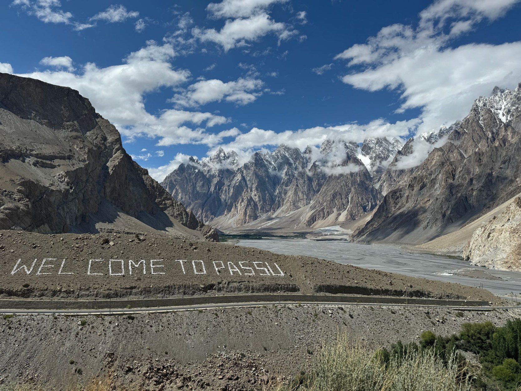
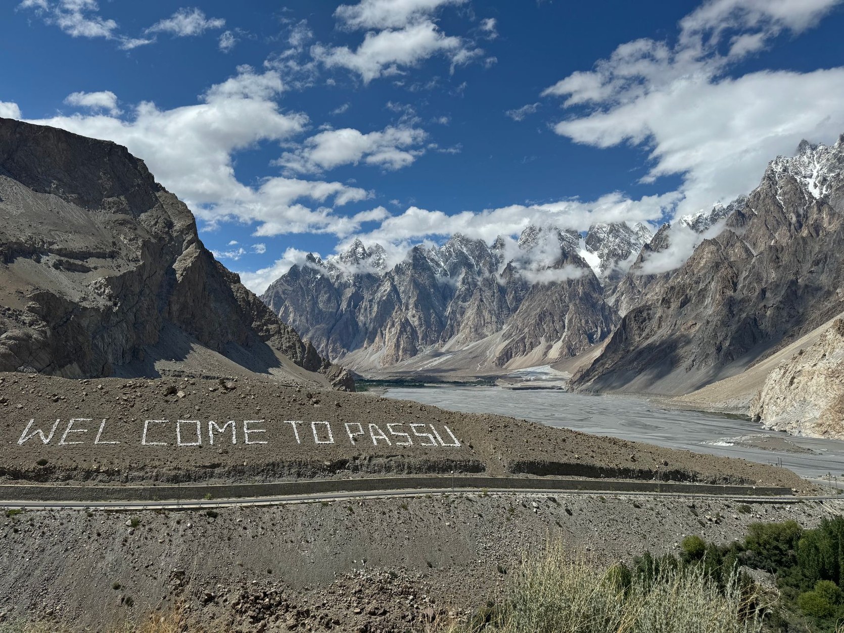
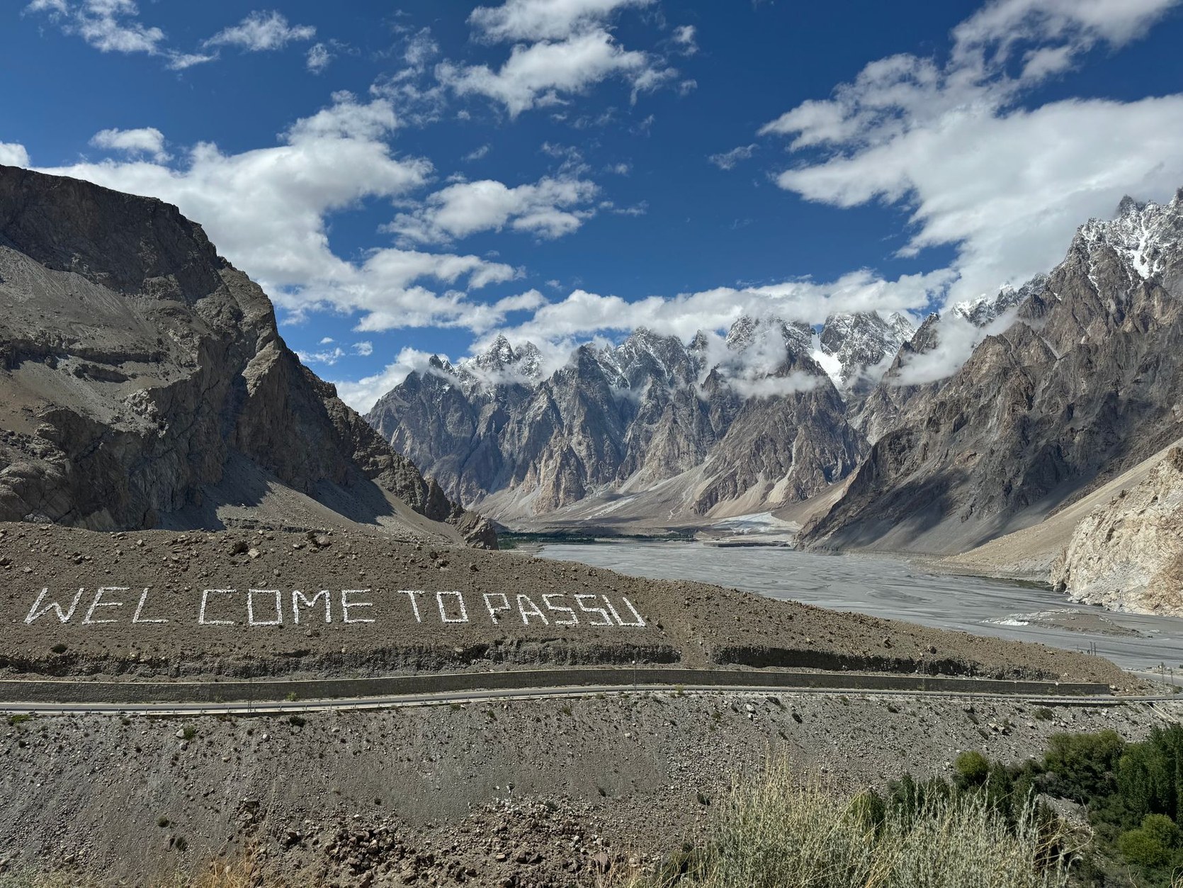
Boating across Attabad Lake on a brightly painted wooden launch reveals water so vivid in color that it seems synthetic, created by glacial rock flour suspended in high-altitude sunlight. Beyond the tunnels lies the village of Passu, framed by the cathedral-like serrated granite spires of the Passu Cones (Passu Cathedral, 6,106m).
Near Passu, test your balance on the famous Passu Suspension Bridge. Spanning the silt-laden torrents of the Hunza River, this wire rope bridge features widely spaced wooden slats that sway in mountain gusts, connecting local Wakhi shepherds to seasonal alpine pastures.
Spend the afternoon exploring nearby Borith Lake, a saline mountain pool that serves as an essential staging ground for migratory wildfowl crossing the Himalayas.
Day 8: Khunjerab Pass — The Roof of the World
On morning eight, embark on an ascent to Khunjerab Pass (4,693m), the geographical climax of the Karakoram Highway. Located eighty kilometres north of Passu inside Khunjerab National Park, this windswept pass forms the highest paved international border crossing in the world, separating Pakistan from China’s Xinjiang region.
The road climbs steadily past glacial moraines and high alpine tundra where golden marmots sun themselves on granite boulders. At the summit stands a monumental stone border gate flanked by Pakistani and Chinese frontier guards, operating beneath oxygen-thin skies where snow flurries can occur even in midsummer.
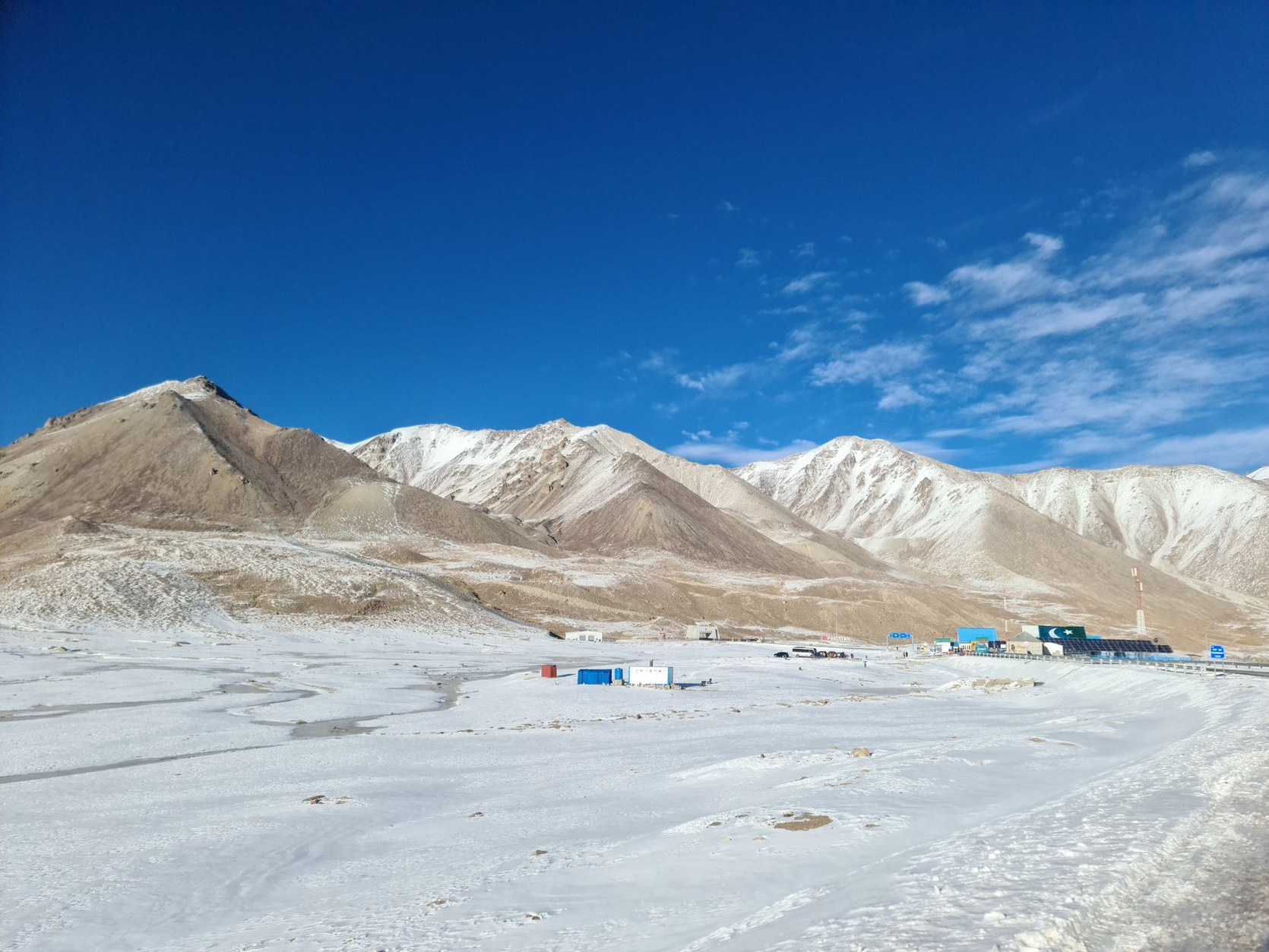
After admiring this remote frontier, descend southward along the KKH back to Gilgit for your final overnight stay.
Day 9: Departure Transit & Mountain Flight Contingencies
On your final morning, board your return flight from Gilgit to Islamabad, enjoying a final aerial view of the Himalayan and Karakoram peaks. Upon landing at Islamabad International Airport, connect to your onward international flight or take an afternoon to purchase Kashmiri pashmina shawls and mountain dried fruits before departure.
Street Smarts: Tourist Scams, Overpriced Traps & Transit Hazards in Pakistan
Northern Pakistan is celebrated for extraordinary hospitality, where travellers are welcomed with generosity and respect. However, high-altitude alpine travel, visual flight logistics, and regional permits require vigilant preparation to avoid travel disruptions.
- Islamabad–Gilgit Flight Cancellation Realities: Flights between Islamabad and Gilgit operated by Pakistan International Airlines (PIA) rely on Visual Flight Rules (VFR). Even moderate cloud cover over the mountain passes results in immediate cancellation, with roughly forty percent of flights grounded during weather shifts. Never schedule an international departure flight on the same afternoon as your mountain return. Always maintain an overland 4×4 contingency plan with a reputable driver who can navigate the KKH or Babusar Pass if flights are suspended.
- Special Communication Organization (SCO) Cellular Restrictions: Historically, major domestic SIM cards from Punjab (such as Jazz and Zong) had restricted functionality in Gilgit-Baltistan due to local telecommunications regulations favoring the regional SCO network. Modern roaming agreements allow select 4G data access, but coverage can drop suddenly outside main towns. Equipping an international eSIM configured for regional roaming ensures you maintain GPS tracking across key highway transit points.
- Attabad Lake Boat Charter Overcharging: At the boat docks along Attabad Lake, independent boatmen frequently quote inflated rates ($18–$28) for simple twenty-minute tourist excursions. The regulated charter rate for a return excursion is far less per boat. Negotiate firmly before boarding, ensure all passengers are provided functional life vests, and verify whether the fare is per person or for the entire vessel.
- Police Checkpoint Documentation & Restricted Zones: Travelling along the Karakoram Highway involves passing multiple police and military checkpoints (such as at Danyor, Jaglot, and Aliabad). Foreign nationals must register their passports and visas. While Hunza Valley no longer requires a No Objection Certificate (NOC) for standard tourism, wandering off marked routes toward military border areas or the Line of Control requires special permits. Always carry at least ten paper photocopies of your passport main page and Pakistani e-Visa to hand to checkpoint officers quickly.
- Acute Mountain Sickness (AMS) at Khunjerab Pass: Driving from Karimabad (2,400m) to Khunjerab Pass (4,693m) involves ascending over 2,200 vertical metres in less than three hours. At 4,700 metres, atmospheric oxygen is roughly half that of sea level. Rapid ascent frequently triggers headaches, dizziness, and shortness of breath. Spend at least two full nights acclimatizing in central Hunza before attempting the pass, stay well hydrated, and limit physical exertion at the border gate.
- Unboiled Water & Digestive Health Precautions: Tap water in mountain guesthouses comes directly from untreated glacial streams or river channels containing fine mineral silt and agricultural runoff. Drinking unboiled tap water or consuming uncooked salads washed in local water frequently causes severe bacterial dysentery. Drink exclusively bottled, filtered, or boiled water, and ensure hot dishes like daal, biryani, and roasted meats are freshly cooked.
By respecting local cultural traditions and preparing for mountain weather variables, you will navigate northern Pakistan safely, forging enduring memories of one of the world’s greatest alpine journeys.
Karakoram Highway Transit & Mobile Connectivity with NXTL
Navigating the Karakoram Highway and remote mountain valleys of Gilgit-Baltistan requires continuous mobile connectivity. High-altitude mountain passes lack regular signage; offline satellite mapping and live GPS tracking are vital when coordinating private 4×4 drivers, monitoring Babusar Pass weather reports, and tracking flight departure confirmations at Gilgit Airport. Reliable mobile data is equally essential for booking guesthouses in Karimabad and maintaining family contact across deep mountain gorges.
Standard foreign cellular roaming packages rarely operate reliably across the Karakoram range or incur exorbitant roaming charges. Equipping your smartphone with an authentic NXTL Pakistan travel eSIM ensures dependable, high-speed mobile data throughout your journey. Leveraging tier-one carrier partnerships with Jazz and Zong 4G/LTE—Pakistan’s leading nationwide network operators—NXTL provides connectivity in urban Islamabad, along major sections of the Karakoram Highway, and across key towns in the Hunza Valley.
| Travel Profile | Primary Daily Mobile Usage | Estimated 9-Day Data | Cost at $0.93/GB |
|---|---|---|---|
| Light Navigator | Google Maps GPS tracking, driver coordination, flight monitoring, messaging | 1.5 GB | $1.39 |
| Balanced Explorer | Mountain trail GPS navigation, photo uploads, restaurant research, Careem rideshare | 4.5 GB | $4.17 |
| Heavy Digital Nomad | Continuous 4G/LTE hotspot tethering, remote work video calls, streaming, cloud backups | 10.0 GB | $9.26 |
The NXTL travel connectivity model provides unmatched flexibility for overland adventurers. Operating across 180+ supported countries and 460+ carrier networks, your single NXTL eSIM remains reusable across international borders without tedious reinstallation. An initial purchase of $11.99 includes $10.00 in preloaded data credit, which never expires as long as your account remains active. Because data is billed strictly on a pay-as-you-go basis, you only pay for the precise megabytes you consume, eliminating wasteful expiring daily bundles.
Furthermore, mobile hotspot and tethering are fully permitted across Pakistan, allowing you to connect your laptop or tablet in mountain guesthouses effortlessly. With dual-SIM capability, your physical home carrier SIM stays active in your phone for essential two-factor banking SMS and emergency voice calls, while NXTL handles all data traffic at local rates starting from just $0.93/GB. Setting up takes minutes via a simple QR code scan before you depart, ensuring that as soon as your aircraft touches down at Islamabad Airport, your phone connects to the local LTE grid automatically.
From the gleaming white marble minarets of Faisal Mosque and the ancient timber ramparts of Baltit Fort to the turquoise waters of Attabad Lake and the soaring granite spires of the Passu Cones, northern Pakistan rewards those who travel with curiosity, respect, and careful preparation. Pack a warm fleece, carry your camera, and prepare for an extraordinary journey across the roof of the world.